Biking Around NZ - January Diary
|
|
1st Jan 2011 - A Wander in the Bush and a Superb Coastal Bike Ride
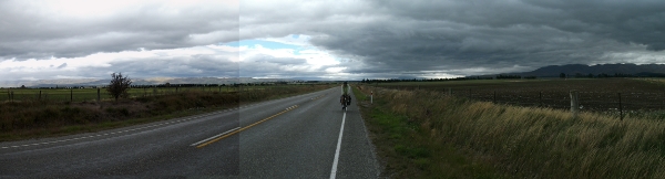
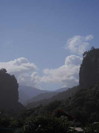 About 30 miles (48kms say) by bike and a few miles walked. We started the New Year by getting going at 10am so we could do a bush walk around the Punakaiki Valley - a limestone gorge similar (from memories of previous hols) to the Gorges du Tarn. Limestone cliffs tower up hundreds of feet. The river itself it pretty cold since I considered swimming but proceeded no further than paddling (my feet went numb). We eventually took a track back to Punakaiki village. In total about 3 hours walking followed by a double scoop ice cream of hokey pokey and honey 'n fig. I phoned my mum and sisters back in the UK to wish them all (for at 1pm NZ time it was midnight UK time) a very happy New Year. Let us hope it's a year of true peace, honesty, love, and perhaps for some of us, books by the heap and a decent level of beer.. About 30 miles (48kms say) by bike and a few miles walked. We started the New Year by getting going at 10am so we could do a bush walk around the Punakaiki Valley - a limestone gorge similar (from memories of previous hols) to the Gorges du Tarn. Limestone cliffs tower up hundreds of feet. The river itself it pretty cold since I considered swimming but proceeded no further than paddling (my feet went numb). We eventually took a track back to Punakaiki village. In total about 3 hours walking followed by a double scoop ice cream of hokey pokey and honey 'n fig. I phoned my mum and sisters back in the UK to wish them all (for at 1pm NZ time it was midnight UK time) a very happy New Year. Let us hope it's a year of true peace, honesty, love, and perhaps for some of us, books by the heap and a decent level of beer..
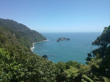
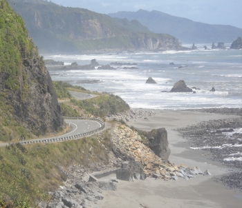 We then recovered our bags from the dense bush where we'd hidden them while we walked, and headed for Greymouth. There's wonderful coastal scenery along this route - massive cliffs, big waves, and a fairly quiet road.Eventually reached Greymouth, deliberately arriving before 5pm so we could call in on the brewery tours to check the situation. Of course, today it is sensibly closed for New Year, so we'll have to return tomorrow.Guy's bee stings, he's had three, are slowly recovering. He seems to have bee collecting cycling clothing. Perhaps he needs a bee keepers outfit instead. Fortunately they just have given him a few swollen lumps.We are now in the rather expensive Top 10 Holiday Park - $20 each to pitch a tent - that's about £10 per person - recovering from a great deal of salad. We then recovered our bags from the dense bush where we'd hidden them while we walked, and headed for Greymouth. There's wonderful coastal scenery along this route - massive cliffs, big waves, and a fairly quiet road.Eventually reached Greymouth, deliberately arriving before 5pm so we could call in on the brewery tours to check the situation. Of course, today it is sensibly closed for New Year, so we'll have to return tomorrow.Guy's bee stings, he's had three, are slowly recovering. He seems to have bee collecting cycling clothing. Perhaps he needs a bee keepers outfit instead. Fortunately they just have given him a few swollen lumps.We are now in the rather expensive Top 10 Holiday Park - $20 each to pitch a tent - that's about £10 per person - recovering from a great deal of salad.
|
|
2nd Jan 2011 - a Brewery and a Beach
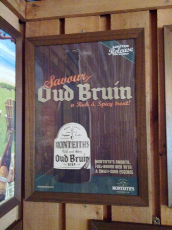 A visit to Monteith's Brewery made today a stationary day. The guides go a bundle about Monteiths and from the hype you'd think they were a little craft brewery but dig a little and you see that they are now a big industrial combine (like Macs brewery, their main competitor) that likes to pose as a craft brewer. Indeed, Monteith's is the big west coast brewery, owned by DB Brewing. But they do produce quite a pleasant black lager under the name Black Beer and most of their beers are decent if not exciting or particularly notable. It's unfortunate that they don't do bottle or cask fermenting - no more yeast is added at bottling/fermenting. Nor do they do a dark ale - only a dark lager. They are keen on this clean reproducible flavour, which makes the beers reliable but a touch dull. Hops are pelleted and grown near Nelson.The tour was pretty slick - I'd guess our tour guide had done the spiel many times before. It showed us a modern, fairly large brewery focussed on lagers. It included pretty generous sampling - including the chance to pull your own beer which we both did. More than once.... The museum display shows that they have brewed old style porter, brown beers, even tripels and saisons. And wheats. So their current range looks like what happens when a small creative brewery gets the treatment from big management after a takeover. Reliable but a bit dull and designed more by the marketing dept perhaps than exciting brewing. Where are the wonderful old brews that the museum's bottles and ads mention? There was evidently once a vibrant brewing culture here - belgian style saisons and brown beers. What on earth happened?Make mine an oud bruin....The rest of the day was largely occupied by a few hours walking along the beach, seeing the point where the Grey River enters the sea and not quite finding our way around the bungalowed backstreets in time for evensong at Holy Trinity, a sad blow since as a devotee of choral (preferably) evensong as one of the most underrated liturgies I had longed for a fix of Nunc Dimittis and perhaps an antipodean sermon. They did have a service later called 19:29, hmm I guess this is to indicate the sort of age range their after and as I'm a fair bit out of that age bracket and frankly noah's ark in terms of my liturgical sensibilities I backed away, cowed.Greymouth is an unpretentious town in a wonderful, if rainy as today, location and I warmed to it. However we must get some miles done tomorrow and try to get a decent amount of the way towards those glaciers that we see advertised everywhere. A visit to Monteith's Brewery made today a stationary day. The guides go a bundle about Monteiths and from the hype you'd think they were a little craft brewery but dig a little and you see that they are now a big industrial combine (like Macs brewery, their main competitor) that likes to pose as a craft brewer. Indeed, Monteith's is the big west coast brewery, owned by DB Brewing. But they do produce quite a pleasant black lager under the name Black Beer and most of their beers are decent if not exciting or particularly notable. It's unfortunate that they don't do bottle or cask fermenting - no more yeast is added at bottling/fermenting. Nor do they do a dark ale - only a dark lager. They are keen on this clean reproducible flavour, which makes the beers reliable but a touch dull. Hops are pelleted and grown near Nelson.The tour was pretty slick - I'd guess our tour guide had done the spiel many times before. It showed us a modern, fairly large brewery focussed on lagers. It included pretty generous sampling - including the chance to pull your own beer which we both did. More than once.... The museum display shows that they have brewed old style porter, brown beers, even tripels and saisons. And wheats. So their current range looks like what happens when a small creative brewery gets the treatment from big management after a takeover. Reliable but a bit dull and designed more by the marketing dept perhaps than exciting brewing. Where are the wonderful old brews that the museum's bottles and ads mention? There was evidently once a vibrant brewing culture here - belgian style saisons and brown beers. What on earth happened?Make mine an oud bruin....The rest of the day was largely occupied by a few hours walking along the beach, seeing the point where the Grey River enters the sea and not quite finding our way around the bungalowed backstreets in time for evensong at Holy Trinity, a sad blow since as a devotee of choral (preferably) evensong as one of the most underrated liturgies I had longed for a fix of Nunc Dimittis and perhaps an antipodean sermon. They did have a service later called 19:29, hmm I guess this is to indicate the sort of age range their after and as I'm a fair bit out of that age bracket and frankly noah's ark in terms of my liturgical sensibilities I backed away, cowed.Greymouth is an unpretentious town in a wonderful, if rainy as today, location and I warmed to it. However we must get some miles done tomorrow and try to get a decent amount of the way towards those glaciers that we see advertised everywhere.
|
|
3rd Jan 2011 - Greymouth to Hokitika in the Rain
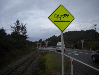 A very wet day with wheel problems so we ended up at Shining Star Holiday Park in Hokitika with a mere 25 miles (and those with a helpful tail wind) under our wheels. We set off from Greymouth campsite at a decent hour - not much after 10am - but after a shop at the New World Supermarket we decided that my back wheel looked terrible, that the tyre bought in Wellington at the start of the trip was now a mess of bald patches and in one place the inner tube was peeking through the side wall. I know that Conti Sports Contact tyres are speedy but not long-lived so we went into Greymouth to find tyres. One shop was closed (New Year hols continue) and the other had nothing suitable (26 x 1.3 or thereabouts) so we headed off. The road south is pretty flat so we made good time until the back wheel punctured. I realised that unless it was rapidly replaced it would puncture every few miles since the tread was now so poor. So the puncture got mended and we headed to Hokitika where in pouring rain we found a bike shop and they had a 26x1.25 so bingo... I changed the tyre outside a display of a boat called 'The Countess', which claimed to be, I think, to be the only life boat ever built in NZ... suffice to say it was a large and nicely polished boat but nothing like the size of a modern lifeboat. I suppose it's the old equivalent of an RIB boat. Certainly a nice old boat, hope it gets on the water sometimes. By the time all this kerfufle had been completed it was 4.30pm and we were both wet and cold, with the rain coming on harder. The next place to stay isn't that far but won't have showers (just a tent spot and a cafe) which were deemed essential as we looked at each other, grease stained from changing tyres a couple of times and besmattered with mud from the road.So we ended up in Hokitika, famous I think for a beach art competition, though the beach today is very much like a cool blustery and wet day in July at Skegness.Broccolli in cider sauce again since I'm trying to use up the heap of butter and flour I'm carrying. I may just leave it behind for some other camper.... The journey today did include a fair bit of road and rail sharing - they don't build a separate bridge for road and rail but expect them to share. Excellent. Though the sign makes clear the dangers of rails for bikes... A very wet day with wheel problems so we ended up at Shining Star Holiday Park in Hokitika with a mere 25 miles (and those with a helpful tail wind) under our wheels. We set off from Greymouth campsite at a decent hour - not much after 10am - but after a shop at the New World Supermarket we decided that my back wheel looked terrible, that the tyre bought in Wellington at the start of the trip was now a mess of bald patches and in one place the inner tube was peeking through the side wall. I know that Conti Sports Contact tyres are speedy but not long-lived so we went into Greymouth to find tyres. One shop was closed (New Year hols continue) and the other had nothing suitable (26 x 1.3 or thereabouts) so we headed off. The road south is pretty flat so we made good time until the back wheel punctured. I realised that unless it was rapidly replaced it would puncture every few miles since the tread was now so poor. So the puncture got mended and we headed to Hokitika where in pouring rain we found a bike shop and they had a 26x1.25 so bingo... I changed the tyre outside a display of a boat called 'The Countess', which claimed to be, I think, to be the only life boat ever built in NZ... suffice to say it was a large and nicely polished boat but nothing like the size of a modern lifeboat. I suppose it's the old equivalent of an RIB boat. Certainly a nice old boat, hope it gets on the water sometimes. By the time all this kerfufle had been completed it was 4.30pm and we were both wet and cold, with the rain coming on harder. The next place to stay isn't that far but won't have showers (just a tent spot and a cafe) which were deemed essential as we looked at each other, grease stained from changing tyres a couple of times and besmattered with mud from the road.So we ended up in Hokitika, famous I think for a beach art competition, though the beach today is very much like a cool blustery and wet day in July at Skegness.Broccolli in cider sauce again since I'm trying to use up the heap of butter and flour I'm carrying. I may just leave it behind for some other camper.... The journey today did include a fair bit of road and rail sharing - they don't build a separate bridge for road and rail but expect them to share. Excellent. Though the sign makes clear the dangers of rails for bikes...
|
|
4th Jan 2011 - Hokitika to Harihari in the Rain
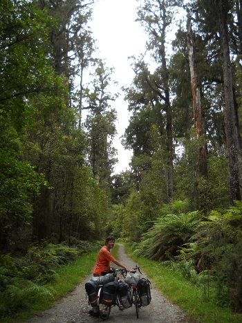 About 45 miles or 72 kms from Hokitika to Harihari. We set off at a decent time and glad that the rain had stopped. The road south from Hokitika is initially flat and then becomes more undulating as you leave the coast. The road is frequently closed in by bush - quite mature trees and dense undergrowth. At Ross we met an British couple who are taking some time to go around the world and bike in the various countries they visit. They've done thousands of miles already and don't have a ticket back into the UK until August. They are evidently early retireds considering the world as a place to explore and what better way than by bike. They have lovely bikes - rather liked the Thorn Sherpa with Rohloff enclosed rear hub - very positive about its sheer reliability. They, Karen and Steve, have a web site at www.my-bicycling-adventure.com. Between Ross and Harihari there is the Bushmans Centre dedicated to the craft of living in the bush, and also to wild food. It is a tough landscape to cross since it is both hilly and densely wooded - with a density of ferns and bushes (the rain is heavy on the west coast as we are finding out). Plus big rivers frequently cut across the coastal plain down to the sea. Greymouth itself has suffered repeated floods.We reached Harihari early at 3.30pm and considered ploughing on to Franz Josef, where the glaciers are, but then the rain started and we felt like taking cover - in Harihari Motor Camp and Hotel. Well, we're with the plebs in the camping section. There is a small shop and cafe (closed at 5pm but a decent little place with some very nice spinach and ricotta pies) opposite the hotel.We're going to try out the bar - don't suppose it has the anarchic humour of the Whangamomona Hotel back on North Island but may be an interesting experience... (Later....) Chatted to Steve and Carol, mentioned earlier. Fascinating to hear how they have been cycling, on and off, since 2009 in various parts of the world including a big loop around Europe. The beer was Christmas Ale - I asked for a sample which, frankly, bemused them, then asked 'why is it specifically Cristmas Ale, is it spicy or something? And that bemused them even more since it is just a pleasant brown beer, brewed around Christmas. But decent ale if nothing Christmassy...Hmm, tomorrow we will reach the glacier town of Franz Josef at last. About 45 miles or 72 kms from Hokitika to Harihari. We set off at a decent time and glad that the rain had stopped. The road south from Hokitika is initially flat and then becomes more undulating as you leave the coast. The road is frequently closed in by bush - quite mature trees and dense undergrowth. At Ross we met an British couple who are taking some time to go around the world and bike in the various countries they visit. They've done thousands of miles already and don't have a ticket back into the UK until August. They are evidently early retireds considering the world as a place to explore and what better way than by bike. They have lovely bikes - rather liked the Thorn Sherpa with Rohloff enclosed rear hub - very positive about its sheer reliability. They, Karen and Steve, have a web site at www.my-bicycling-adventure.com. Between Ross and Harihari there is the Bushmans Centre dedicated to the craft of living in the bush, and also to wild food. It is a tough landscape to cross since it is both hilly and densely wooded - with a density of ferns and bushes (the rain is heavy on the west coast as we are finding out). Plus big rivers frequently cut across the coastal plain down to the sea. Greymouth itself has suffered repeated floods.We reached Harihari early at 3.30pm and considered ploughing on to Franz Josef, where the glaciers are, but then the rain started and we felt like taking cover - in Harihari Motor Camp and Hotel. Well, we're with the plebs in the camping section. There is a small shop and cafe (closed at 5pm but a decent little place with some very nice spinach and ricotta pies) opposite the hotel.We're going to try out the bar - don't suppose it has the anarchic humour of the Whangamomona Hotel back on North Island but may be an interesting experience... (Later....) Chatted to Steve and Carol, mentioned earlier. Fascinating to hear how they have been cycling, on and off, since 2009 in various parts of the world including a big loop around Europe. The beer was Christmas Ale - I asked for a sample which, frankly, bemused them, then asked 'why is it specifically Cristmas Ale, is it spicy or something? And that bemused them even more since it is just a pleasant brown beer, brewed around Christmas. But decent ale if nothing Christmassy...Hmm, tomorrow we will reach the glacier town of Franz Josef at last.
|
|
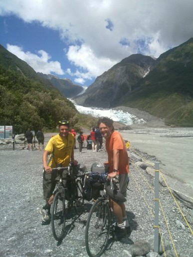
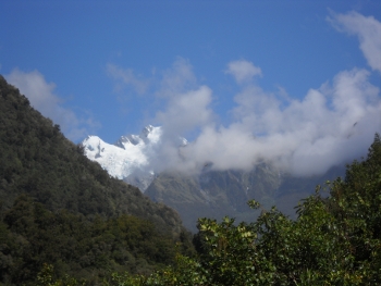
5th Jan 2011 - Glaciers At Last!
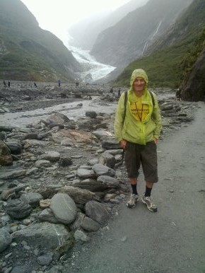 Today we did about 70kms (so about 44 miles) going from Harihari (where the rain made us think of harikari) Tavern's motor camp to Top10 Holiday Park, Franz Josef, including a trip to the very face of the glacier itself.They sell sunglasses in the shop in Harihari where we had breakfast (the omelette was very good), which led to the following exchange....Q: What is the point of sunglasses on NZ's west coast? A: They stop the bees flying into your eyes.Ah, the truth because it is, of course, raining steadily and there is no chance today as for the last, oh, 4 or 5 days that we will see the sun.We left Harihari just after Steve and Carol, the long term round the world cyclists. We then stopped to appreciate a replica of Guy Menzies biplane which, in 1931, flew across the Tasman Sea so becoming the first to solo fly across to NZ from Oz. He crashed into the La Fontaine swamp, ending up upside down. But he was unhurt. He died in 1940, off the coast of Sicily in a Sunderland, shot down by the Italian Airforce. A thrilling life, if short. Today we did about 70kms (so about 44 miles) going from Harihari (where the rain made us think of harikari) Tavern's motor camp to Top10 Holiday Park, Franz Josef, including a trip to the very face of the glacier itself.They sell sunglasses in the shop in Harihari where we had breakfast (the omelette was very good), which led to the following exchange....Q: What is the point of sunglasses on NZ's west coast? A: They stop the bees flying into your eyes.Ah, the truth because it is, of course, raining steadily and there is no chance today as for the last, oh, 4 or 5 days that we will see the sun.We left Harihari just after Steve and Carol, the long term round the world cyclists. We then stopped to appreciate a replica of Guy Menzies biplane which, in 1931, flew across the Tasman Sea so becoming the first to solo fly across to NZ from Oz. He crashed into the La Fontaine swamp, ending up upside down. But he was unhurt. He died in 1940, off the coast of Sicily in a Sunderland, shot down by the Italian Airforce. A thrilling life, if short.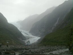 There's a fair sized hill shortly after Harihari and then a series of more modest ups and downs with, today, the rain steadily soaking us along with sweat since it's warm and humid. We bought a basic lunch in Whataroa (lovely name) where Carol and Steve rolled into town as we were leaving - they are carrying more than us and have slower rolling tyres (mountain bike style). We passed various lakes, crossed several full and muddy rivers on one lane bridges and hauled up, booked in, drank some tea and pitched in the rain. Then we cycled the 5 kms to the start of the glacier walk, which took us just over an hour walking mostly on a river bed to get to within about 100 yards of the glacier face.The proximity of the glacier makes the air very cold. It's a tremendous sight, descending from a long line of 3000+m mountains, including Mt Cook (3754m) and Mt Tasman (3497m). Not such good visibility today and raining steadily but still a tremendous sight.Then back via a very pretty church - St. James - 1931 in a half timbered clapperboard style. The East Window, or altar window, has a view of glaciers (at the moment - it retreated between 1954-ish and 1995-ish).Now back at the campsite with a heap of shopping, about to embark on the construction of a mega salad.Oh and if you thnk my yellow cagoul (photo above) is horribly dirty and seems to be growing mould, well yes but I just can't find anything as good at a decent price... Even the mould has become an (m)old friend. |
|
6th Jan 2011 - Heavy Rain and Strong Winds
We awoke to the sound of heavy rain and a buffeting wind. Since we were hoping to do the other glacier, Fox Glacier, todaykthis was bad news. Indeed you could hardly see more than 200m in the downpour. We had breakfast and decided to take the tent down - which was in a very exposed position and suffering from big gusts. As it was being taken down a big gust distorted the wholetent and a bit of the main pole gave way. So we had to get that fixed in town if possible - tho' we ended up mending it ourselves with a drinks can since there is no camping equipment shop of any sort in Franz Josef. The heavy rain persuaded us to have a reading, mending, washing sort of day. In town we heard of flood warnings ad it looked a bit like Murchison all over again.I read a huge amount of Tristram Shandy by Sterne, and Guy was rereading Proust and getting wearied by Odette de Crecy.The campers were all huddled in the kitchen for the best part of the day as the rain poured. No mountains were visible any more just rain. The campers are, particularly here, a mix from all over the world, though mostly Europeans. A German baby crawled over to play happily with my bike pump , some Chinese were getting a little tipsy on Tui Beer (the local favourite), and the French were watching tennis in the recreation room. The Brits were deep in classic literature. A discussion of the loss of the indonesian beef and cattle market was underway (apparently the Ozzies taught the Indonesians about farming, and so they stopped importing Oz's beef, etc)
|
|
7th Jan 2011 - Another Day, Another Glacier (Mint?)
 From Franz Josef to Pine Lodge Motel and Camping, about 70kms with a deviation to see Fox Glacier from a couple of different vantage points. So about 44 miles. We awoke to the sound of light rain so we weren't optimistic. Fortunately it soon stopped and patches of blue appeared in the sky. We got going at about 11am after I'd phoned my mum and we then headed straight for the 4 square supermarket for some lunch food. Then up and over a fair sized climb to get to Fox, with excellent views and improving weatherIn Fox we asked the info centre about places to stay between Fox and Haast and were told of this place - Pine Lodge. It's good value at $25 for a tent (50 for a cabin which takes two). Then we visited Fox Glacier - roped back 1km from the glacier face because the river is in flood after all the rain, so less fun than Franz Josef Glacier but evidently just as incredible a phenomenon. Met Steve and Carol (see previous entries) and took pics of our bikes and ourselves looking intrepid with waterfalls and glaciers behind us.We also went to the glacier viewpoint and also dipped our fingers in a hot spring on the way to the glacier viewpoint. From Franz Josef to Pine Lodge Motel and Camping, about 70kms with a deviation to see Fox Glacier from a couple of different vantage points. So about 44 miles. We awoke to the sound of light rain so we weren't optimistic. Fortunately it soon stopped and patches of blue appeared in the sky. We got going at about 11am after I'd phoned my mum and we then headed straight for the 4 square supermarket for some lunch food. Then up and over a fair sized climb to get to Fox, with excellent views and improving weatherIn Fox we asked the info centre about places to stay between Fox and Haast and were told of this place - Pine Lodge. It's good value at $25 for a tent (50 for a cabin which takes two). Then we visited Fox Glacier - roped back 1km from the glacier face because the river is in flood after all the rain, so less fun than Franz Josef Glacier but evidently just as incredible a phenomenon. Met Steve and Carol (see previous entries) and took pics of our bikes and ourselves looking intrepid with waterfalls and glaciers behind us.We also went to the glacier viewpoint and also dipped our fingers in a hot spring on the way to the glacier viewpoint.
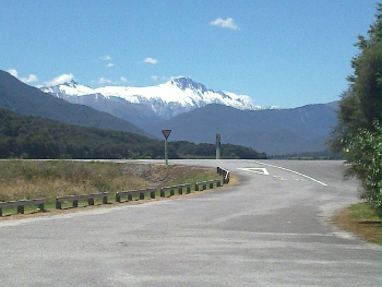
 Then did the 35kms or so to Pine Lodge, crossing the Cook River where we think we glimpsed Mt Cook - see the photo. We passed a cyclist (from Minnesota we're told), with an impressive silver beard, who was speeding towards Fox. At Pine Lodge several cyclists were staying since it is a staging point on the way to Haast. Steve, Carol, a Dunedin biker, and us, all compared notes on cycling in various places, homesickness, Christmas, and other diverse subjects. We discussed people cycling in parts of Asia which reminded us of http://www.herebeelephants.com - the blog of the daughter of our former local Folk Club president - Viva El Presidente! Then did the 35kms or so to Pine Lodge, crossing the Cook River where we think we glimpsed Mt Cook - see the photo. We passed a cyclist (from Minnesota we're told), with an impressive silver beard, who was speeding towards Fox. At Pine Lodge several cyclists were staying since it is a staging point on the way to Haast. Steve, Carol, a Dunedin biker, and us, all compared notes on cycling in various places, homesickness, Christmas, and other diverse subjects. We discussed people cycling in parts of Asia which reminded us of http://www.herebeelephants.com - the blog of the daughter of our former local Folk Club president - Viva El Presidente!
|
|
8th Jan 2011 - Making Haste to Haast
 From Pine Lodge Motel and Camping through to Haast Lodge (and camping) - about 90 kms which is a shade under 60 miles, say 56.The day started slowly since neither of us emerged from sleep until a bit after 8am.... We breakfasted and I got a bit obsessed with getting another percent of Tristram Shandy read (ebooks don't have neat page numbers since you can alter the font size so it becomes a matter of percents...). Eventually got on the road at abut 10.30am. There's a lovely rolling undulating road going south through heavily wooded bush. After about 30 or so kms we reached a salmon farm that does food and so we had smoked salmon rolls for lunch. Not very vegetarian but not much really to eat otherwise, and I am partial to smoked salmon, though preferably organic RSPCA monitored and so on (to salve my veggie conscience). An american couple chatted to us as we were leaving, doing NZ by car but curious to see some of the world by bike. The girl, Anita, was impressed by the distance we'd covered, and the man in her life was impressed by the heavy weight of the bike, which he accurately guessed to be over 50lbs. We encouraged them to look at http://www.adventurecycling.org - a superb site for cycling in the USA.There were fish in ponds there but curiously they were, apparently, trout....We passed lots of hives, some being smoked by a crowd of bee keepers. We cycled through some fairly cross looking swarms of bees - fast. I think they were a still a bit drowsy from smoke. Then on past a couple of lakes to the coast at Knight's Point - a great viewpoint over the Tasman Sea, and the biggest climb of the day. Then a very quick dip in Ship Creek (recommended by a friendly cyclist from Dunedin) - made briefer by the sheer numbers of sand flies. Then on to Haast, the road flattening out until we crossed the Haast River (via the longest bridge on the west coast - mostly concrete single track) and shopped and pitched camp.Today has been gorgeous weather, with Steve and Carol a litttle ahead of us (perhaps an hour ahead). We all met up in the evening over food and bottles of beer. There's a curious map that Guy spotted on a wall - an old antique map with the names Ulster Island (North Island), Munster or Middle Island (South Island), and Leinster or South Island (Stewart Island). Ah, it'll please anyone of Irish extraction no doubt, and shows a fanciful, to modern eyes, way of seeing NZ.Tristram Shandy contains a passage on travel, that I've just read - 'So much motion, continues he [Bp Hall] (for he was very corpulent) - is so much unquietness; and so much of rest, by the same analogy, is so much of heaven.... Now I (being very thin) think differently; and that so much of motion, is so much of life, and so much of joy - and that to stand still, or get on but slowly, is death and the devil-'Truth lies, I suppose on both sides of this! From Pine Lodge Motel and Camping through to Haast Lodge (and camping) - about 90 kms which is a shade under 60 miles, say 56.The day started slowly since neither of us emerged from sleep until a bit after 8am.... We breakfasted and I got a bit obsessed with getting another percent of Tristram Shandy read (ebooks don't have neat page numbers since you can alter the font size so it becomes a matter of percents...). Eventually got on the road at abut 10.30am. There's a lovely rolling undulating road going south through heavily wooded bush. After about 30 or so kms we reached a salmon farm that does food and so we had smoked salmon rolls for lunch. Not very vegetarian but not much really to eat otherwise, and I am partial to smoked salmon, though preferably organic RSPCA monitored and so on (to salve my veggie conscience). An american couple chatted to us as we were leaving, doing NZ by car but curious to see some of the world by bike. The girl, Anita, was impressed by the distance we'd covered, and the man in her life was impressed by the heavy weight of the bike, which he accurately guessed to be over 50lbs. We encouraged them to look at http://www.adventurecycling.org - a superb site for cycling in the USA.There were fish in ponds there but curiously they were, apparently, trout....We passed lots of hives, some being smoked by a crowd of bee keepers. We cycled through some fairly cross looking swarms of bees - fast. I think they were a still a bit drowsy from smoke. Then on past a couple of lakes to the coast at Knight's Point - a great viewpoint over the Tasman Sea, and the biggest climb of the day. Then a very quick dip in Ship Creek (recommended by a friendly cyclist from Dunedin) - made briefer by the sheer numbers of sand flies. Then on to Haast, the road flattening out until we crossed the Haast River (via the longest bridge on the west coast - mostly concrete single track) and shopped and pitched camp.Today has been gorgeous weather, with Steve and Carol a litttle ahead of us (perhaps an hour ahead). We all met up in the evening over food and bottles of beer. There's a curious map that Guy spotted on a wall - an old antique map with the names Ulster Island (North Island), Munster or Middle Island (South Island), and Leinster or South Island (Stewart Island). Ah, it'll please anyone of Irish extraction no doubt, and shows a fanciful, to modern eyes, way of seeing NZ.Tristram Shandy contains a passage on travel, that I've just read - 'So much motion, continues he [Bp Hall] (for he was very corpulent) - is so much unquietness; and so much of rest, by the same analogy, is so much of heaven.... Now I (being very thin) think differently; and that so much of motion, is so much of life, and so much of joy - and that to stand still, or get on but slowly, is death and the devil-'Truth lies, I suppose on both sides of this!
|
|
9th Jan 2011 - Hasta La Vista Haast!
 A superb day of mountains and waterfalls, in which we covered about 80kms or 50 miles. The day started briskly with breakfast and a conversation with a lady, whose husband was off fishing, about Maori. We had been puzzled about how to pronounce long series of vowels in Maori placenames and the lady was a Maori language teacher at Middle School. She said the phrase 'are there three or two' (aeiou) gives you the pronunciation and then you just have to remember to pronounce each vowel in the word - that they don't combine to make a different sound. A superb day of mountains and waterfalls, in which we covered about 80kms or 50 miles. The day started briskly with breakfast and a conversation with a lady, whose husband was off fishing, about Maori. We had been puzzled about how to pronounce long series of vowels in Maori placenames and the lady was a Maori language teacher at Middle School. She said the phrase 'are there three or two' (aeiou) gives you the pronunciation and then you just have to remember to pronounce each vowel in the word - that they don't combine to make a different sound.
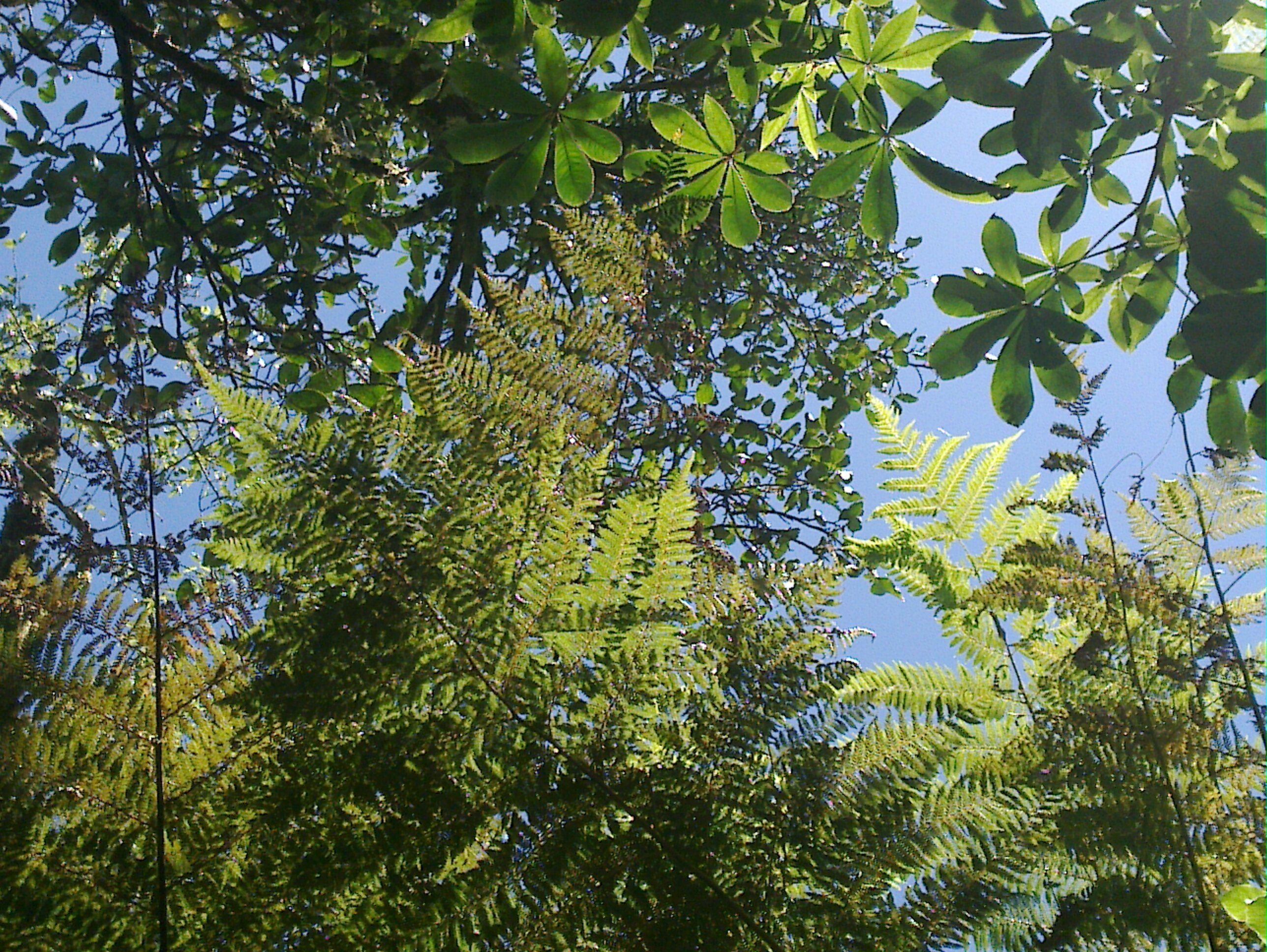
 We were running short of cash because we haven't seen an ATM since Franz Josef and so our purchases before leaving were frugal. Then we headed off, shouting 'Haast is Past', the road initially flat to undulating along the Haast River with beautiful views of mountain and river. A short walk at one point to see the woods and the waterfall Roaring Billy. The leaves against the sun were something special - mistletoe and tree ferns and palms - as above. Click on the image to the see the full image which I've been using as a screensaver. Then we had lunch at, I think, Pleasant Flat Camping and Scenic Reserve where we met Phillip who is a Maori evangelist on a bike. He travels by bike and lives to preach the gospel. There something very appropriate about a bike as his means of transport - he himself reminded us of Wesley's travels by horse. He has a website at http://philkeelan.info though he warned us that he doesn't worry about updating it often. The view from Pleasant Flat Camping and Scenic Reserve is pretty good - Mount Hooker was in the distance, covered in snow - the photo above.Then up the Haast Pass - some initial steep climbs to the Gates of Haast followed by some more gentle ascents to the final rather unimpressive summit, or col, at about 574m. Well there's ascents in Yorkshire that reach that height. Then down the pass pretty rapidly with a short diversion for the Blue Pool walk - ok but we've seen lots of pools of this turquoise colour recently.Then down to Makorora where there's a campground / holiday park ($25 camping for two). Met up again with Carol and Steve and drank a pint of local draught bitter - pretty standard. We were running short of cash because we haven't seen an ATM since Franz Josef and so our purchases before leaving were frugal. Then we headed off, shouting 'Haast is Past', the road initially flat to undulating along the Haast River with beautiful views of mountain and river. A short walk at one point to see the woods and the waterfall Roaring Billy. The leaves against the sun were something special - mistletoe and tree ferns and palms - as above. Click on the image to the see the full image which I've been using as a screensaver. Then we had lunch at, I think, Pleasant Flat Camping and Scenic Reserve where we met Phillip who is a Maori evangelist on a bike. He travels by bike and lives to preach the gospel. There something very appropriate about a bike as his means of transport - he himself reminded us of Wesley's travels by horse. He has a website at http://philkeelan.info though he warned us that he doesn't worry about updating it often. The view from Pleasant Flat Camping and Scenic Reserve is pretty good - Mount Hooker was in the distance, covered in snow - the photo above.Then up the Haast Pass - some initial steep climbs to the Gates of Haast followed by some more gentle ascents to the final rather unimpressive summit, or col, at about 574m. Well there's ascents in Yorkshire that reach that height. Then down the pass pretty rapidly with a short diversion for the Blue Pool walk - ok but we've seen lots of pools of this turquoise colour recently.Then down to Makorora where there's a campground / holiday park ($25 camping for two). Met up again with Carol and Steve and drank a pint of local draught bitter - pretty standard.
|
|
10th Jan 2011 - A Bike Ride by the Lakes to Wanaka
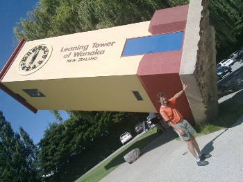 A day of pretty much exactly 40 miles, or say 63kms, going from Makorora to Wanaka Kiwi Holiday Park. A pretty easy day's cycling. Down to Lake Wanaka on Highway 6 then along the Lake - delightful views of water and mountains (very like a Scottish loch). Then over a small climb and down to Lake Hawea. After a few kms we said hello to Steve and Karen as we wooshed on down the lake. Then we reached the bottom of Lake Hawea and took the road to Wanaka, passing 'Puzzling World' where we stopped briefly, intrigued by all the mazes (two levels!), labyrinths, rubik cubes, optical oddities and the like, tho' we hadn't yet reached a cash machine so we didn't pay the entrance and actually go in.Finally, reached Wanaka where I needed a new back tyre (Conti Sports Contacts 1.3 tyres do not last a long time especially under load on the back). Eventually bought the nearest thing Wanaka has to my tyre size - a 26 x 1.15, so pretty much a road tyre with even less off road viability.Then discovered the New World supermarket, where I bought the kind of food we haven't seen for a couple of hundred miles - organic yoghurt with greek honey, dark rye bread, thai curry soup.Then finally to the campsite - pitched and Guy went off to do a second food shop.Wanaka is evidently dedicated to thrills, sight-seeing on an industrial scale, and the humbler pleasures of ice cream, dining out and swimming in Lake Wanaka. Scenic flights and sky diving are evidently big here. I think we'll stay with the bikes. It is nice to see sailing boats out on the lake. In fact the place reminds me a little bit of Keswick. Lakes, mountains, parkland and a busy small-ish town. A day of pretty much exactly 40 miles, or say 63kms, going from Makorora to Wanaka Kiwi Holiday Park. A pretty easy day's cycling. Down to Lake Wanaka on Highway 6 then along the Lake - delightful views of water and mountains (very like a Scottish loch). Then over a small climb and down to Lake Hawea. After a few kms we said hello to Steve and Karen as we wooshed on down the lake. Then we reached the bottom of Lake Hawea and took the road to Wanaka, passing 'Puzzling World' where we stopped briefly, intrigued by all the mazes (two levels!), labyrinths, rubik cubes, optical oddities and the like, tho' we hadn't yet reached a cash machine so we didn't pay the entrance and actually go in.Finally, reached Wanaka where I needed a new back tyre (Conti Sports Contacts 1.3 tyres do not last a long time especially under load on the back). Eventually bought the nearest thing Wanaka has to my tyre size - a 26 x 1.15, so pretty much a road tyre with even less off road viability.Then discovered the New World supermarket, where I bought the kind of food we haven't seen for a couple of hundred miles - organic yoghurt with greek honey, dark rye bread, thai curry soup.Then finally to the campsite - pitched and Guy went off to do a second food shop.Wanaka is evidently dedicated to thrills, sight-seeing on an industrial scale, and the humbler pleasures of ice cream, dining out and swimming in Lake Wanaka. Scenic flights and sky diving are evidently big here. I think we'll stay with the bikes. It is nice to see sailing boats out on the lake. In fact the place reminds me a little bit of Keswick. Lakes, mountains, parkland and a busy small-ish town.
|
|
11th Jan 2011 - Over NZ's Highest Road
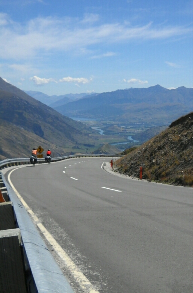 From Wanaka Lakeview Campground (Kiwi Holiday Parks) to Queenstown Lakeview Campground (Kiwi Holiday Parks) - pretty much exactly 50 miles or 80kms. We took the Cardrona road which goes up over the highest paved road in NZ. Cardrona was reached in time for a leisurely lunch and is famous for the 'Gin and the Raspberry' phrase - shouted on discovery of a gold nugget and later turned into a folk song (as sung notably by Damien Barber). Cardrona is also a name that turns up, with gold mining related themes, in other songs. Tourists are odd creatures. No one visited the heritage site while we were there though one person took a photo without leaving their campervan and anothr got his wife to read out the information board, without either leaving their vehicle, but started driving away as she was reading.The valley is gentle up to Cardrona but then gets steeper - and the last bit up to a bit over 1000m above see level is around 1 in 6 for a fair km or two. At the top we met Steve and Carol. We took photos, even got an american tourist to take photos of the four of us, plus photos of various of us heading off downhill towards Queenstown.The ride down was fun, superb views so I took some video footage of the mountains, and a cyclist.Then we diverted into Arrowtown, a quaint place but evidently, as Queenstown, a real estate boom was on (half a million dollars for a smallish log cabin style plot?). We viited, with Carol and Steve, the Arrowtown Brewery, which is basically a bar with some stainless steel vats behind. The Schist Stout was excellent. Sadly no bottles available to keep for this evening.Then finally a hilly run to Queenstown round the back of the Shotover River (very Lord of the Rings territory this), through Arthur's Point and down into Queenstown. The Top 10 Camping was full but they had space at the Kiwi Holiday Park. This is a fairly sad place - more like a car park than a campsite, with little space per site and no decent landscaping (e.g.. trees). They charged us $20 each to camp and then they have the nerve to charge $2 to have a shower. I think they've won the 'Meanest Campsite' award of our travels. Queenstown is devoted to thrills in a rather brainless way, so perhaps the guests are not up to noticing the ripoffs. We can't decide whether it is to be tandem skydiving, parasailing, jetboating, whitewater rafting or simply a nice scenic heli flight with a landing on a couple of snow fields. Ah, choices, choices. It makes an evening with Tristram Shandy (free ebook) seem like stunningly good value. I took a video of the landscape as we came down from the highest point on the Cardrona to Queenstown road. From Wanaka Lakeview Campground (Kiwi Holiday Parks) to Queenstown Lakeview Campground (Kiwi Holiday Parks) - pretty much exactly 50 miles or 80kms. We took the Cardrona road which goes up over the highest paved road in NZ. Cardrona was reached in time for a leisurely lunch and is famous for the 'Gin and the Raspberry' phrase - shouted on discovery of a gold nugget and later turned into a folk song (as sung notably by Damien Barber). Cardrona is also a name that turns up, with gold mining related themes, in other songs. Tourists are odd creatures. No one visited the heritage site while we were there though one person took a photo without leaving their campervan and anothr got his wife to read out the information board, without either leaving their vehicle, but started driving away as she was reading.The valley is gentle up to Cardrona but then gets steeper - and the last bit up to a bit over 1000m above see level is around 1 in 6 for a fair km or two. At the top we met Steve and Carol. We took photos, even got an american tourist to take photos of the four of us, plus photos of various of us heading off downhill towards Queenstown.The ride down was fun, superb views so I took some video footage of the mountains, and a cyclist.Then we diverted into Arrowtown, a quaint place but evidently, as Queenstown, a real estate boom was on (half a million dollars for a smallish log cabin style plot?). We viited, with Carol and Steve, the Arrowtown Brewery, which is basically a bar with some stainless steel vats behind. The Schist Stout was excellent. Sadly no bottles available to keep for this evening.Then finally a hilly run to Queenstown round the back of the Shotover River (very Lord of the Rings territory this), through Arthur's Point and down into Queenstown. The Top 10 Camping was full but they had space at the Kiwi Holiday Park. This is a fairly sad place - more like a car park than a campsite, with little space per site and no decent landscaping (e.g.. trees). They charged us $20 each to camp and then they have the nerve to charge $2 to have a shower. I think they've won the 'Meanest Campsite' award of our travels. Queenstown is devoted to thrills in a rather brainless way, so perhaps the guests are not up to noticing the ripoffs. We can't decide whether it is to be tandem skydiving, parasailing, jetboating, whitewater rafting or simply a nice scenic heli flight with a landing on a couple of snow fields. Ah, choices, choices. It makes an evening with Tristram Shandy (free ebook) seem like stunningly good value. I took a video of the landscape as we came down from the highest point on the Cardrona to Queenstown road.
|
|
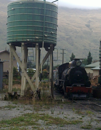
12th Jan 2011 - Queenstown? We Prefer Kingston
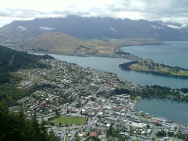 A day of two halves - we only got onto our bikes at lunchtime and so we did a short afternoon of about 30 miles or 45 kms. In the morning we experienced the Queenstown gondola - a cable car to a point some 400 metres or more above the town. It is impressive and does give you, for $25, a spacious view over the town, lake and mountains. There the usual vertiginous quality to the ride - rockfaces lie below your bubble of metal, and coming back down is particularly good as the car leaves the station and heads out into the void of air and sunlight.In the afternoon we had the option to keep cycling in the evening and push on a bit, but a strong headwind kept our speed down to mostly below 10mph, and a nut sheared off on my pannier rack so it's a bit wobbly and lashed up with bungees, so we decided (given a positive forecast for tomorrow) to stop at Kingston where there are remnants of the old railway line in the form of a station, some steam locos and some elegant carriages looking, sadly, a little neglected. Well comparing them to, say, Keighley and Worth Valley Railway(perhaps a bit unfair given that this is a small village).Though Queenstown may make you doubt that the milk of human kindness still exists, with its overpriced big city ways, at Kingston I had a $10 returned to me after it blew away unnoticed in the strong breeze and then a Dane who had once cycled NZ (Auckland to Invercargill and back, including kayaking in the Abel Tasman National Park) donated a substantial amount of curry (fortunately full of veg) to us. They have a blog, http://shomann.blogspot.com, in Danish but even for non-Danish speakers it does have great pictures.Question for the day: altho' good for the economy (but then so is warfare and manufacturing poison gas), is it really a good idea to fly people half way round the world to spend their time partying and buying various rather mindless thrills? Is NZ just a bigger version of a theme park with rides? Bah humbug!! A day of two halves - we only got onto our bikes at lunchtime and so we did a short afternoon of about 30 miles or 45 kms. In the morning we experienced the Queenstown gondola - a cable car to a point some 400 metres or more above the town. It is impressive and does give you, for $25, a spacious view over the town, lake and mountains. There the usual vertiginous quality to the ride - rockfaces lie below your bubble of metal, and coming back down is particularly good as the car leaves the station and heads out into the void of air and sunlight.In the afternoon we had the option to keep cycling in the evening and push on a bit, but a strong headwind kept our speed down to mostly below 10mph, and a nut sheared off on my pannier rack so it's a bit wobbly and lashed up with bungees, so we decided (given a positive forecast for tomorrow) to stop at Kingston where there are remnants of the old railway line in the form of a station, some steam locos and some elegant carriages looking, sadly, a little neglected. Well comparing them to, say, Keighley and Worth Valley Railway(perhaps a bit unfair given that this is a small village).Though Queenstown may make you doubt that the milk of human kindness still exists, with its overpriced big city ways, at Kingston I had a $10 returned to me after it blew away unnoticed in the strong breeze and then a Dane who had once cycled NZ (Auckland to Invercargill and back, including kayaking in the Abel Tasman National Park) donated a substantial amount of curry (fortunately full of veg) to us. They have a blog, http://shomann.blogspot.com, in Danish but even for non-Danish speakers it does have great pictures.Question for the day: altho' good for the economy (but then so is warfare and manufacturing poison gas), is it really a good idea to fly people half way round the world to spend their time partying and buying various rather mindless thrills? Is NZ just a bigger version of a theme park with rides? Bah humbug!!
|
|
13th Jan 2011 - Kingston to Te Anau
 From Kingston motor camp through to Te Anau, a distance of 112kms, or about 70 miles. This was a great day for cycling. The sun came out and the headwind dropped to almost nothing. From Kingston to Athol is pretty gentle then there's a modest col or saddle (a cyclist waved as we sat there, eating our lunch) after which we hurtled down to the 'Five Rivers' (once known as the Punjab since that also means five rivers) area and took the turning for Mossburn. The road to Mossburn is flat and, with little wind, we were soon at The town. It's a small town with a lot of traffic - heading for Milford Sound and Te Anau. It's a friendly place. We noticed a cut out cowboy leaning against the timber of the veranda of the shop - the lady (born in Bluff, where we will be going) who owned it said it was made by a local and we mentioned that we last saw one, oh six years ago, in the USA. She said it was obtained so she had a man, albeit a pretty inactive one, in her life. She said that she couldn't live in a city and we said neither could we, we just existed in the ugly city which might be considered home.Then we headed out, eventually reaching a more substantial col with great views to distant mountains after a few miles of gentle climbing. A scottish (well, St Andrews flag was prominently displayed) cycling duo shot past at high speed down hill towards Mossburn - all lycra and snazzy. Wonderful quiet sunny countryside, with lovely windreaks of firs planted in great rows over the grassland. Almost like an Alice in Wonderland chessboard.Then on through the curiously named hamlet of The Key, then towards a distant range of hills over the now increasingly flat landscape. And then we arrived in Te Anau.Shopped, where a man leaving the shop said to me - you need a car for all that stuff. I replied that we didn't need a car - we'd got just the space for our shopping and wasn't he worried about the price of oil - $100 a barrel isn't it. This terminated the exchange. The man (of course) looked like a spot of cycling to the shops would do him a world of good, a bit overweight, etc.Then pitched up at Te Anau Top 10 Camping at a discount (kindly lady!) on the official price of $23 each to camp. It is next to the YHA and so has the advantage I can us the YHA cheap wireless while staying at the campsite next door. From Kingston motor camp through to Te Anau, a distance of 112kms, or about 70 miles. This was a great day for cycling. The sun came out and the headwind dropped to almost nothing. From Kingston to Athol is pretty gentle then there's a modest col or saddle (a cyclist waved as we sat there, eating our lunch) after which we hurtled down to the 'Five Rivers' (once known as the Punjab since that also means five rivers) area and took the turning for Mossburn. The road to Mossburn is flat and, with little wind, we were soon at The town. It's a small town with a lot of traffic - heading for Milford Sound and Te Anau. It's a friendly place. We noticed a cut out cowboy leaning against the timber of the veranda of the shop - the lady (born in Bluff, where we will be going) who owned it said it was made by a local and we mentioned that we last saw one, oh six years ago, in the USA. She said it was obtained so she had a man, albeit a pretty inactive one, in her life. She said that she couldn't live in a city and we said neither could we, we just existed in the ugly city which might be considered home.Then we headed out, eventually reaching a more substantial col with great views to distant mountains after a few miles of gentle climbing. A scottish (well, St Andrews flag was prominently displayed) cycling duo shot past at high speed down hill towards Mossburn - all lycra and snazzy. Wonderful quiet sunny countryside, with lovely windreaks of firs planted in great rows over the grassland. Almost like an Alice in Wonderland chessboard.Then on through the curiously named hamlet of The Key, then towards a distant range of hills over the now increasingly flat landscape. And then we arrived in Te Anau.Shopped, where a man leaving the shop said to me - you need a car for all that stuff. I replied that we didn't need a car - we'd got just the space for our shopping and wasn't he worried about the price of oil - $100 a barrel isn't it. This terminated the exchange. The man (of course) looked like a spot of cycling to the shops would do him a world of good, a bit overweight, etc.Then pitched up at Te Anau Top 10 Camping at a discount (kindly lady!) on the official price of $23 each to camp. It is next to the YHA and so has the advantage I can us the YHA cheap wireless while staying at the campsite next door.
|
|
14th Jan 2011 - Fixing My Bike and a Walk in the Woods
 A day spent mending my bike, doing the laundry, planning the next stage of our bike ride (a visit by bike to Milford Sound, with a trip out on the Sound) and a three hour walk along the Kepler Track. The Mower and Cycle place (which seems to be joined to a garage) fixed the broken off screw (pannier fixing) quickly by drilling out the middle and then the screw could be turned. They replaced it with a steel (rather than the previous aluminium) screw. Looks stronger.Met two other cyclists - Anna and Liam from Germany/UK. Liam was doing the thing so many cyclists do when in a sunny spot stationary - drying his socks. They intend to do Milford via the various campsites on the way. They had old fashioned road bikes, which always pleases Guy.Then a chunk of the Kepler Track, from Rainbow Reach to Motorua Hut. The Hut was impressive - spacious and with flush loos and cooking facilities. Beautiful beech forests so took a fair few photos. Then texts flew and we met up with Steve and Carole for a beer - easy considering that they have pitched up next to us (they've got a sturdier looking tent than ours - maybe a touch bigger - a classic tunnel tent. It weighs a bit more but is that bit more comfy I suspect. Our tent, though small, feels like a palace after the tiny tent (still in decent condition) that we took across the USA.Had some excellent local wheat beers and porters - Tuatara or suchlike brewery. We must find out more.We felt a bit sad that such a beautiful hot day was spent partially on mundane mending and laundry - we hoped we would have similar weather tomorrow. A day spent mending my bike, doing the laundry, planning the next stage of our bike ride (a visit by bike to Milford Sound, with a trip out on the Sound) and a three hour walk along the Kepler Track. The Mower and Cycle place (which seems to be joined to a garage) fixed the broken off screw (pannier fixing) quickly by drilling out the middle and then the screw could be turned. They replaced it with a steel (rather than the previous aluminium) screw. Looks stronger.Met two other cyclists - Anna and Liam from Germany/UK. Liam was doing the thing so many cyclists do when in a sunny spot stationary - drying his socks. They intend to do Milford via the various campsites on the way. They had old fashioned road bikes, which always pleases Guy.Then a chunk of the Kepler Track, from Rainbow Reach to Motorua Hut. The Hut was impressive - spacious and with flush loos and cooking facilities. Beautiful beech forests so took a fair few photos. Then texts flew and we met up with Steve and Carole for a beer - easy considering that they have pitched up next to us (they've got a sturdier looking tent than ours - maybe a touch bigger - a classic tunnel tent. It weighs a bit more but is that bit more comfy I suspect. Our tent, though small, feels like a palace after the tiny tent (still in decent condition) that we took across the USA.Had some excellent local wheat beers and porters - Tuatara or suchlike brewery. We must find out more.We felt a bit sad that such a beautiful hot day was spent partially on mundane mending and laundry - we hoped we would have similar weather tomorrow.
|
|
15th Jan 2011 - a Bike Ride to Milford Sound
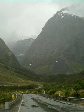 From Top 10 Camping, Te Anau, to Milford Lodge (backpackers dorms) at Milford Sound, a distance of about 120 kms or 75 miles.We woke to the sound of a strong breeze in the trees and indeed, after almost no wind yesterday we have a headwind today! This wind was gusty so for a fair bit of the time it was gentle - especially in the beech woods - but a few gusts brought us to a standstill. Guy did sterling work leading the caravan while Steve did a fair bit of slipstreaming (but my bike weighed more! S). Windy along Lake Te Anau, then up a bit to the mirror lakes, then on to Lake Gunn, still uphill mostly but not steep, then on to The Divide where we had a brief downhill after turning towards Milford. Then a bit of a slog for 10kms or so, in steady rain and a gusty wind with the temperature tumbling, to reach the Homer Tunnel (no not that or that Homer, this one was a 19th Century explorer who first proposed the tunnel though it wasn't built until the period 1940-1953 - didn't stop us thinking 'doh!' as we cycled through). From Top 10 Camping, Te Anau, to Milford Lodge (backpackers dorms) at Milford Sound, a distance of about 120 kms or 75 miles.We woke to the sound of a strong breeze in the trees and indeed, after almost no wind yesterday we have a headwind today! This wind was gusty so for a fair bit of the time it was gentle - especially in the beech woods - but a few gusts brought us to a standstill. Guy did sterling work leading the caravan while Steve did a fair bit of slipstreaming (but my bike weighed more! S). Windy along Lake Te Anau, then up a bit to the mirror lakes, then on to Lake Gunn, still uphill mostly but not steep, then on to The Divide where we had a brief downhill after turning towards Milford. Then a bit of a slog for 10kms or so, in steady rain and a gusty wind with the temperature tumbling, to reach the Homer Tunnel (no not that or that Homer, this one was a 19th Century explorer who first proposed the tunnel though it wasn't built until the period 1940-1953 - didn't stop us thinking 'doh!' as we cycled through).
The steady climb up to the tunnel passes through a tremendous landscape - tremendous but not exactly beautiful since there is really too much bare rock for that. Just huge rocky mountains with little grass and few trees until you reach the valley floor. Some ice was lying in gullies below us - evidently tumbled off the rocks above. There are waterfalls everywhere - the water just seems to run straight off the hills in high cascades. Evidence of rockfalls or avalanches was common.The tunnel was no problem though dark and a bit damp - nicer than the weather outdoors. The video was taken when I was just very glad to get there - I knew that it was downhill all the way from there and at times I'd wondered if we would arrive after dark. Don't let anyone put you off biking to Milford Sound from Te Anau. The tunnel is no problem if approached with your lights at the ready and a willingness to get to the side if dazzled or deafened, and the ride is one of the most spectacular in the world. The vast majority of drivers will cheer you on or light your way through the tunnel rather than scare you. The road surface in the tunnel is a bit rough and you really have got to go slowly though. Then down to Milford Sound with a 20km downhill! Arrived at about 8.30pm having left Te Anau at about 11am. We visited a beauty spot called The Chasm on the way down, where a river, on meeting softer rock, has dug a larger version of the Ingleton waterfalls and ravines.The Milford Lodge where we stayed is OK but one partially broken kettle between everyone is ridiculous and the complete absence of milk to buy is a sadness. Why not keep a little UHT on the shelves? Or even fresh milk in the freezer. The staff member I dealt with answered most of my questions negatively (no, there's no milk, the kitchen is about to close for cleaning so you've hardly much time to cook, no there's nowhere for your bike to be put) while smiling warmly at me as if she was being helpful.
|
|
16th Jan 2011 - Milford Sound
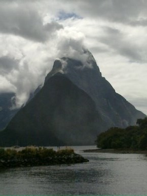 A day spent at Milford Sound exploring the area by boat, bike and on foot, before putting our bikes on a bus and returning to Te Anau. A day mostly of steady rain and leaden skies. But, apart from the rare days of sun, that's basically how it is at one of the wettest places in the world.Despite the fact that the terminal was opened by the minister for the environment, there was no provision for parking bikes anywhere. We were told by security not to take them into the terminal building and he also told us that we had ignored traffic regulations by bringing them through the tunnel. According to him, bikes are not allowed tis side of the tunnel. However this is all so much error and baloney, probably propagated by the tourist industry who very evidently want a monopoly on travel. We were warned yesterday how tough the bike ride to here is and yet on a day with a headwind and rain is was still a superb and reasonably manageable ride. It is one of the great biking roads of the world. Once on the boat, Guy was already feeling queasy, then it was announced that we would be poking our nose out into the Tasman Sea, the roaring forties. Apparently a hundred millimetres of rain fell last night but it is not unheard of for five hundred millimetres to fall in a 24 hr period, making this the wettest part of NZ.We were then told that Milford Sound was named in error as it is not a Sound (formed by a river - V shaped) but a Fjiord (formed by a glacier - U shaped). Predictably enough once we crossed the terminal moraine that formed the shelf of the Fjiord, Guy turned a funy colour and was sick, leaving Steve free to watch seals and photograph 'disappearing' waterfalls to his heart's content. They 'disappear' when the wind catches them as they fall turning them into a fine mist which is blown over the sea.The boat trip was, effectively, a tour of waterfalls, only four of which are permanent, apparently, since the rest just appear during/after heavy rain, so we saw them. But you can see where Mitre Peak would be... The Tasman Sea was not particularly windy - the Sound created a windier area as the wind is forced between towering peaks. My Nokia N900 camera was fine with the damp but my camera, Nikon, went a bit fuzzy focussed. Hope it recovers.Then we waited to catch a bus which takes bikes to whisk us back to Te Anau where we could continue our progress to Cape Bluff. The bus took a shade under two hours to do the whisking and then we repitched our tent at the Top 10 Holiday Park. A day spent at Milford Sound exploring the area by boat, bike and on foot, before putting our bikes on a bus and returning to Te Anau. A day mostly of steady rain and leaden skies. But, apart from the rare days of sun, that's basically how it is at one of the wettest places in the world.Despite the fact that the terminal was opened by the minister for the environment, there was no provision for parking bikes anywhere. We were told by security not to take them into the terminal building and he also told us that we had ignored traffic regulations by bringing them through the tunnel. According to him, bikes are not allowed tis side of the tunnel. However this is all so much error and baloney, probably propagated by the tourist industry who very evidently want a monopoly on travel. We were warned yesterday how tough the bike ride to here is and yet on a day with a headwind and rain is was still a superb and reasonably manageable ride. It is one of the great biking roads of the world. Once on the boat, Guy was already feeling queasy, then it was announced that we would be poking our nose out into the Tasman Sea, the roaring forties. Apparently a hundred millimetres of rain fell last night but it is not unheard of for five hundred millimetres to fall in a 24 hr period, making this the wettest part of NZ.We were then told that Milford Sound was named in error as it is not a Sound (formed by a river - V shaped) but a Fjiord (formed by a glacier - U shaped). Predictably enough once we crossed the terminal moraine that formed the shelf of the Fjiord, Guy turned a funy colour and was sick, leaving Steve free to watch seals and photograph 'disappearing' waterfalls to his heart's content. They 'disappear' when the wind catches them as they fall turning them into a fine mist which is blown over the sea.The boat trip was, effectively, a tour of waterfalls, only four of which are permanent, apparently, since the rest just appear during/after heavy rain, so we saw them. But you can see where Mitre Peak would be... The Tasman Sea was not particularly windy - the Sound created a windier area as the wind is forced between towering peaks. My Nokia N900 camera was fine with the damp but my camera, Nikon, went a bit fuzzy focussed. Hope it recovers.Then we waited to catch a bus which takes bikes to whisk us back to Te Anau where we could continue our progress to Cape Bluff. The bus took a shade under two hours to do the whisking and then we repitched our tent at the Top 10 Holiday Park.
|
|
17th Jan 2011 - Te Anau to Tuatapere
 From Te Anau (Top 10) to Tautapere (Shooters Motel and Camping) - a distance of about 100kms, or say 63 miles. We're heading south to try to make Cape Bluff in a few days, so we're now about half way to Invercargill, which is near Cape Bluff.The day was mostly undulating farmland with the Fjiordland mountains in the distance. There was a modest col about half way and rocky hills perked the scenery up for a while. We had, for most of the day, a boisterous wind behind us so we made good time. The wind became a moderate headwind for the last 14kms. Not many towns on the route today. Mohapouri early on, by Lake Mohapouri, had an interesting plaque commemorating the Save Lake Mohapouri campaign back in the 70s. I think the campaign not only succeeded in saving the lake from massive reworking for hydroelectric power but also contributed to the bringing down of the government at the subsequent election. We also saw Clifden suspension bridge - from 1899. Fascinating old bridge, no longer in use, and the longest suspension bridge in NZ for a long time. A memorial to Joseph Garthwaite, very Yorkshire, mailboy of 17, who died while trying to get the mail through a swollen river in 1865 (I think - before the bridge), was fixed to the bridge. Tuatapere is a modest town, famous for sausages (not vegetarian so we didn't sample tho' perhaps they have an organic free range sausage that might just tempt us?) and with a few old buildings. Chatted to a retired NZ teacher who talked with us of everything from teaching to books to the NZ of 20 years ago and also the familiar financial chicanery of bankers and accountants (here as much as in the UK). He confirmed that finding a cheap good book in NZ is not easy - unless you are a local and can go to the library. From Te Anau (Top 10) to Tautapere (Shooters Motel and Camping) - a distance of about 100kms, or say 63 miles. We're heading south to try to make Cape Bluff in a few days, so we're now about half way to Invercargill, which is near Cape Bluff.The day was mostly undulating farmland with the Fjiordland mountains in the distance. There was a modest col about half way and rocky hills perked the scenery up for a while. We had, for most of the day, a boisterous wind behind us so we made good time. The wind became a moderate headwind for the last 14kms. Not many towns on the route today. Mohapouri early on, by Lake Mohapouri, had an interesting plaque commemorating the Save Lake Mohapouri campaign back in the 70s. I think the campaign not only succeeded in saving the lake from massive reworking for hydroelectric power but also contributed to the bringing down of the government at the subsequent election. We also saw Clifden suspension bridge - from 1899. Fascinating old bridge, no longer in use, and the longest suspension bridge in NZ for a long time. A memorial to Joseph Garthwaite, very Yorkshire, mailboy of 17, who died while trying to get the mail through a swollen river in 1865 (I think - before the bridge), was fixed to the bridge. Tuatapere is a modest town, famous for sausages (not vegetarian so we didn't sample tho' perhaps they have an organic free range sausage that might just tempt us?) and with a few old buildings. Chatted to a retired NZ teacher who talked with us of everything from teaching to books to the NZ of 20 years ago and also the familiar financial chicanery of bankers and accountants (here as much as in the UK). He confirmed that finding a cheap good book in NZ is not easy - unless you are a local and can go to the library.
|
|
18th Jan 2011 - Frrom Tuatapere to Invercargill
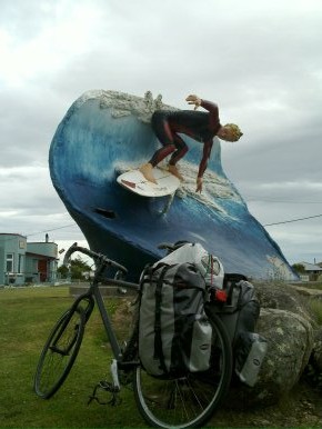 From Tuatapere Shooters' Motel and Camping to Timber Tops Motor Park, a distance of 85kms or about 53 miles. This was a flat to undulating day of cycling with no real climbs, just a few modest small hills. After a quick visit (to buy Apple Strudel and admire the collection of bygones that surround the tables) to the Yesteryear Cafe, we sped south to McCracken's Rest. This is a pleasant overview of the sea, looking out to Bluff and Stewart Island. Then on through quiet countryside to Colac Bay where there is evidently surf sometimes - though not today, surely, since the view from McCracken's Rest showed pretty much a flat sea with a very small swell. There's a wonderful surf monument, or artwork, at Colac Bay. Then we sped on to Riverton which is beautifully situated on, surprise, a river. Just before Riverton we met Doris and John whoare on a multi month trip to NZ - a month or two more than us. They recommended the brewery in Invercargill and we exchanged where we'd been and were planning to go. They looked like they were having an enjoyable trip with some visits to Farmers' Markets to buy organic cheeses, etc. See their blog at http://goseedo.blogspot.com. A very short stop followed, in Invercargill, to eat peanuts and drink orange juice then on to Invercargill in steadily increasing rain. By the time we reached Invercargill we were fairly wet. We called in on the information office (i-site) to check where the brewery was and I'm afraid we both looked muddied and wet in cagouls that frankly are no longer quite what they were (mould, etc). We paddled over to the Invercargill Brewery (http://www.invercargillbrewery.co.nz) where free sampling was available so we tried small amounts of their current range - we liked their belgian style Sister Gina best, though there isn't a dud amongst their entire range. Followed closely by their Pitch Black Stout. Unfortunately their famous Smoked Bishop, a smoked beer and in the 1001 Beers To Try Before You Die, was not currently being brewed since it is a seasonal. We'll have to hope bottles can be unearthed. Finally to the campsite where we pitched in steady rain and adjourned to the kitchen to eat supper accompanied by a bottle of Sister Gina Ale. Rain still tumbling down so it is to be hoped that we've pitched above the flood level... From Tuatapere Shooters' Motel and Camping to Timber Tops Motor Park, a distance of 85kms or about 53 miles. This was a flat to undulating day of cycling with no real climbs, just a few modest small hills. After a quick visit (to buy Apple Strudel and admire the collection of bygones that surround the tables) to the Yesteryear Cafe, we sped south to McCracken's Rest. This is a pleasant overview of the sea, looking out to Bluff and Stewart Island. Then on through quiet countryside to Colac Bay where there is evidently surf sometimes - though not today, surely, since the view from McCracken's Rest showed pretty much a flat sea with a very small swell. There's a wonderful surf monument, or artwork, at Colac Bay. Then we sped on to Riverton which is beautifully situated on, surprise, a river. Just before Riverton we met Doris and John whoare on a multi month trip to NZ - a month or two more than us. They recommended the brewery in Invercargill and we exchanged where we'd been and were planning to go. They looked like they were having an enjoyable trip with some visits to Farmers' Markets to buy organic cheeses, etc. See their blog at http://goseedo.blogspot.com. A very short stop followed, in Invercargill, to eat peanuts and drink orange juice then on to Invercargill in steadily increasing rain. By the time we reached Invercargill we were fairly wet. We called in on the information office (i-site) to check where the brewery was and I'm afraid we both looked muddied and wet in cagouls that frankly are no longer quite what they were (mould, etc). We paddled over to the Invercargill Brewery (http://www.invercargillbrewery.co.nz) where free sampling was available so we tried small amounts of their current range - we liked their belgian style Sister Gina best, though there isn't a dud amongst their entire range. Followed closely by their Pitch Black Stout. Unfortunately their famous Smoked Bishop, a smoked beer and in the 1001 Beers To Try Before You Die, was not currently being brewed since it is a seasonal. We'll have to hope bottles can be unearthed. Finally to the campsite where we pitched in steady rain and adjourned to the kitchen to eat supper accompanied by a bottle of Sister Gina Ale. Rain still tumbling down so it is to be hoped that we've pitched above the flood level...
|
|
19th Jan 2011 - Tent Blown Down Again...
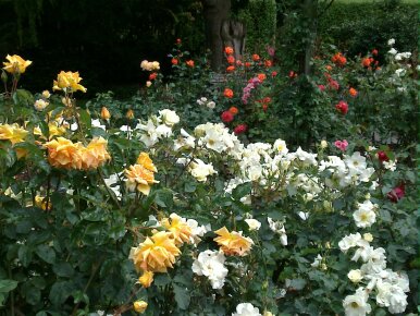 A day spent mending the tent and exploring Invercargill. So lots of miles walked but zero miles cycled. The weather has been windy and wet. The tent pole broke a second time (first time was in Franz Josef) due to a gust that hit it shortly after breakfast. The tent then collapsed, though the rain stopped. The collapsed tent was OK - no longer wobbled in the wind just lay flat on the ground. We left it weighed down and set off to find information about trips to Stewart Island (a rough crossing predicted so we may give that a miss), then we had a look at Henry the Tuatara (a lizard - a foot or so long and born towards the end of the 19th Century) and the art gallery, then we spent ages finding a camping shop that had a fix for the pole (a strong sleeve is now placed around the broken section), then we explored the Queen's Gardens (superb rose gardens), then we tried to find a secondhand bookshop and bakery that we'd seen cycling in yesterday. They were pretty dismal - the bakery seemed to load everything with lard. Then I took tea, to aid my recovery from all this, in the Queen's Gardens while Guy hurried back to the tent to examine the effects of steady rain on a collapsed tent. There is a lovely tea house in Queens' Gardens with pretty decent cakes at a very reasonable price. I realise I have missed National Trust Tea Rooms and pubs with sunny beer gardens. I then shopped for basics, plus a few additional tent pegs (more defences against winds). Then an evening of simple food and interesting conversation with fellow travellers. Is petrol too expensive, too cheap (it hit $100 just recently, seems cheap for a barrel of oil to me), what about canadian tar sands, what is a job for (most people here seemed to be travelling and working), what is the point of travelling, etc. Two canadians, travelling for a year or so gave us their blog address - http://upovertodownunder.blogspot.com A day spent mending the tent and exploring Invercargill. So lots of miles walked but zero miles cycled. The weather has been windy and wet. The tent pole broke a second time (first time was in Franz Josef) due to a gust that hit it shortly after breakfast. The tent then collapsed, though the rain stopped. The collapsed tent was OK - no longer wobbled in the wind just lay flat on the ground. We left it weighed down and set off to find information about trips to Stewart Island (a rough crossing predicted so we may give that a miss), then we had a look at Henry the Tuatara (a lizard - a foot or so long and born towards the end of the 19th Century) and the art gallery, then we spent ages finding a camping shop that had a fix for the pole (a strong sleeve is now placed around the broken section), then we explored the Queen's Gardens (superb rose gardens), then we tried to find a secondhand bookshop and bakery that we'd seen cycling in yesterday. They were pretty dismal - the bakery seemed to load everything with lard. Then I took tea, to aid my recovery from all this, in the Queen's Gardens while Guy hurried back to the tent to examine the effects of steady rain on a collapsed tent. There is a lovely tea house in Queens' Gardens with pretty decent cakes at a very reasonable price. I realise I have missed National Trust Tea Rooms and pubs with sunny beer gardens. I then shopped for basics, plus a few additional tent pegs (more defences against winds). Then an evening of simple food and interesting conversation with fellow travellers. Is petrol too expensive, too cheap (it hit $100 just recently, seems cheap for a barrel of oil to me), what about canadian tar sands, what is a job for (most people here seemed to be travelling and working), what is the point of travelling, etc. Two canadians, travelling for a year or so gave us their blog address - http://upovertodownunder.blogspot.com
|
|
20th Jan 2011 - Bluff
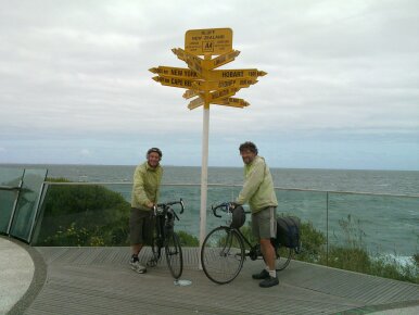 From Invercargill to Bluff and back, so we can officially have done Cape Reinga to Bluff - a distance of about 60kms or 40 miles. We decided to move to a camping site on the road out towards the Catlins, our next area of exploration. So we moved to a campsite and Holiday Park in the south of the city just off the road to Fortrose. Very pleasant with little hedges to prevent strong winds disturbing the camper. Very good idea. After pitching we did the 30-ish kms to Bluff against a cross/headwind and with a lot of heavy trucks passing us. Bluff is more working port than a tourist destination. First stop was the maritime museum which included an old Oyster Boat called Monica. Pretty spartan conditions with little concession to comfort. Bluff Oysters are still a local industry. The museum had some excellent model ships including aa model of Cook's ship The Endeavour. There was also a cannon, sister of one we saw in Invercargill's Southland Museum (though that one has been given an odd raised wooden mounting), purchased for the defence of the area against the Russians but never fired in anger. There were tales of shipwreck and lives saved and lost. Also many stories of ships - quite a few built or from the UK - with histories of owners, wars, drownings and trade. Excellent. There was an old photo showing the ship that we saw at Picton - the Edwin Fox - docked as a floating freezer in Bluff harbour. Funny to think that we've walked on board that ship. Also pictures of the Whaling Vessel 'Chance' (skipper Paddy Gilroy was also featured - a real old sea dog) which was immortalised in the book 'The Cruise of the Cachalot' by Frank Bullens - you can find the book on Gutenberg for free at http://www.gutenberg.org/ebooks/1356. Chance ended up a burnt hulk at Bluff. Then we hurried on againsta headwind to the end of Highway One and the unofficial most southerly point of NZ (actually the real southernmost point is in the Catlins and I expect we'll see it). After the usual pictures, in a freezing wind and with a leaden sky, we adjourned to the Blue Dolphin cafe for a hot drink and watched small boats working their way in a notable swell back to harbour. Some excellent reefs offshore, throwing up a big spray. Then back to Bluff, the road still heavy with trucks, a quick shop at the New World supermarket and back to the tent with some celebratory Invercargill Brewery beers.We noticed the big tourist industry around Stewart Island - flightseeing, heli-hikes, walks, ferries, Kiwi (bird) viewing, etc, etc. Not sure it wouldn't be better to just let the island wildlife alone if it requires so much by way of traffic and noise. It might be a better world if people simply gave wildlife space to live in general rather than burning a heap of fuel and creating a ton of noise to stare at it in the odd corners we've pushed it into. We certainly felt like an endangered species on the road to Bluff. Tofu salad with Pitch Black Stout aided our recovery back at the campsite. From Invercargill to Bluff and back, so we can officially have done Cape Reinga to Bluff - a distance of about 60kms or 40 miles. We decided to move to a camping site on the road out towards the Catlins, our next area of exploration. So we moved to a campsite and Holiday Park in the south of the city just off the road to Fortrose. Very pleasant with little hedges to prevent strong winds disturbing the camper. Very good idea. After pitching we did the 30-ish kms to Bluff against a cross/headwind and with a lot of heavy trucks passing us. Bluff is more working port than a tourist destination. First stop was the maritime museum which included an old Oyster Boat called Monica. Pretty spartan conditions with little concession to comfort. Bluff Oysters are still a local industry. The museum had some excellent model ships including aa model of Cook's ship The Endeavour. There was also a cannon, sister of one we saw in Invercargill's Southland Museum (though that one has been given an odd raised wooden mounting), purchased for the defence of the area against the Russians but never fired in anger. There were tales of shipwreck and lives saved and lost. Also many stories of ships - quite a few built or from the UK - with histories of owners, wars, drownings and trade. Excellent. There was an old photo showing the ship that we saw at Picton - the Edwin Fox - docked as a floating freezer in Bluff harbour. Funny to think that we've walked on board that ship. Also pictures of the Whaling Vessel 'Chance' (skipper Paddy Gilroy was also featured - a real old sea dog) which was immortalised in the book 'The Cruise of the Cachalot' by Frank Bullens - you can find the book on Gutenberg for free at http://www.gutenberg.org/ebooks/1356. Chance ended up a burnt hulk at Bluff. Then we hurried on againsta headwind to the end of Highway One and the unofficial most southerly point of NZ (actually the real southernmost point is in the Catlins and I expect we'll see it). After the usual pictures, in a freezing wind and with a leaden sky, we adjourned to the Blue Dolphin cafe for a hot drink and watched small boats working their way in a notable swell back to harbour. Some excellent reefs offshore, throwing up a big spray. Then back to Bluff, the road still heavy with trucks, a quick shop at the New World supermarket and back to the tent with some celebratory Invercargill Brewery beers.We noticed the big tourist industry around Stewart Island - flightseeing, heli-hikes, walks, ferries, Kiwi (bird) viewing, etc, etc. Not sure it wouldn't be better to just let the island wildlife alone if it requires so much by way of traffic and noise. It might be a better world if people simply gave wildlife space to live in general rather than burning a heap of fuel and creating a ton of noise to stare at it in the odd corners we've pushed it into. We certainly felt like an endangered species on the road to Bluff. Tofu salad with Pitch Black Stout aided our recovery back at the campsite.
|
|
21st Jan 2011 - The Curious Bay
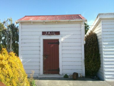 From Invercargill (Amble On Inn Holiday Park) to Curio Bay Campground - about 90kms or 56 miles. Amble On Inn etc is a pretty good campsite, etc, since the kitchen is very comfy and it was with some reluctance that we finally got on the road and headed, initially, for the New World supermarket to get some money out since the next few days probably won't have any cash machines and using credit cards is a more expensive way (min charges apply) of paying for most things. Then out on State Highway 92 against the wind - for the next 40+ kms to Fortrose. The wind was a force 4-5 east north easterly. Fortrose arrived and with no sign of a shop just a cafe. We chatted to two NZ girls who were deciding whether to do the gravel road to Curio Bay (shorter but likely to be slower, possibly even a walk sometimes) or the inland route - windier but all tarmac so with our bikes likely to be faster. They chose the shorter but gravel route - they are on mountain bikes - and we chose the inland route because we hoped to find a shop along the way for our evening meal and some milk. It would probably be faster for us with our narrow tyres. Then on via Tokanui (shop and cafe so we drank tea and ate cake, and stocked up with pasta, sauce and the like). Then on to Waikawa where the Blue Cod Blues chip van fed us on very impressive Blue Cod and chips. Blue Cod is the local variant of cod and we couldn't see any difference - lovely white fish. Fish and chips for $6 each (about £3) seems like a good deal. Just before the turning to Waikawa Guy's rear wheel gave an unhealthy twang and the wheel distorted sufficiently to rub against the rear stayof his bike. A spoke had broken though the bike was not specially heavy (unlike the six pack of Macs Wheat Beer I was carrying when my own wheel lost several spokes). I think we will be having a day in Curio Bay area tomorrow. There seems to be a great deal of wildlife worth seeing. Nice museum buildings - though shut at 6pm when we arrived. Also a rather elegant white colonial style chapel impressed us. Curious how churches in NZ don't usually have graveyards around them (neither did this one). Cemetries are usually out on their own. Finally to Curio Bay (we wll try to find out what the curio is - could be the local petrified trees - ancient trees that have become, over thousands of years, stone). We set up camp at the Curio Bay camping. A fairly basic campground but with a very useful shop and a rather idyllic position on a headland between two bays. But the kitchen is tiny and the place is a bit skimpy on toilets and showers (i.e. there aren't many). It is still breezy so the tent is flapping about as I write but it is lovely to fall asleep to the sound of the sea. There is a real land's end feel to the area - especially since in every direction except north there are thousands of miles of ocean - Antartic south, South America east, Africa west. From Invercargill (Amble On Inn Holiday Park) to Curio Bay Campground - about 90kms or 56 miles. Amble On Inn etc is a pretty good campsite, etc, since the kitchen is very comfy and it was with some reluctance that we finally got on the road and headed, initially, for the New World supermarket to get some money out since the next few days probably won't have any cash machines and using credit cards is a more expensive way (min charges apply) of paying for most things. Then out on State Highway 92 against the wind - for the next 40+ kms to Fortrose. The wind was a force 4-5 east north easterly. Fortrose arrived and with no sign of a shop just a cafe. We chatted to two NZ girls who were deciding whether to do the gravel road to Curio Bay (shorter but likely to be slower, possibly even a walk sometimes) or the inland route - windier but all tarmac so with our bikes likely to be faster. They chose the shorter but gravel route - they are on mountain bikes - and we chose the inland route because we hoped to find a shop along the way for our evening meal and some milk. It would probably be faster for us with our narrow tyres. Then on via Tokanui (shop and cafe so we drank tea and ate cake, and stocked up with pasta, sauce and the like). Then on to Waikawa where the Blue Cod Blues chip van fed us on very impressive Blue Cod and chips. Blue Cod is the local variant of cod and we couldn't see any difference - lovely white fish. Fish and chips for $6 each (about £3) seems like a good deal. Just before the turning to Waikawa Guy's rear wheel gave an unhealthy twang and the wheel distorted sufficiently to rub against the rear stayof his bike. A spoke had broken though the bike was not specially heavy (unlike the six pack of Macs Wheat Beer I was carrying when my own wheel lost several spokes). I think we will be having a day in Curio Bay area tomorrow. There seems to be a great deal of wildlife worth seeing. Nice museum buildings - though shut at 6pm when we arrived. Also a rather elegant white colonial style chapel impressed us. Curious how churches in NZ don't usually have graveyards around them (neither did this one). Cemetries are usually out on their own. Finally to Curio Bay (we wll try to find out what the curio is - could be the local petrified trees - ancient trees that have become, over thousands of years, stone). We set up camp at the Curio Bay camping. A fairly basic campground but with a very useful shop and a rather idyllic position on a headland between two bays. But the kitchen is tiny and the place is a bit skimpy on toilets and showers (i.e. there aren't many). It is still breezy so the tent is flapping about as I write but it is lovely to fall asleep to the sound of the sea. There is a real land's end feel to the area - especially since in every direction except north there are thousands of miles of ocean - Antartic south, South America east, Africa west.
|
|
22nd Jan 2011 - Slope Point - Southernmost Point of NZ Mainland
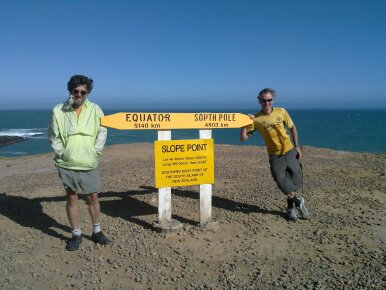 A day, of about 28 miles on the bikes, doing three important things:1. an exploration of the rim of Guy's back wheel to see how bad the breakage is and whether it could last a hundred more miles or so when we'll be, possibly, near a bike shop. The result is that it may last for a while but it won't be fast cycling. We are still pondering whether to try for Invercargill by return bus or push on towards Balclutha and, eventually, Dunedin. 2. a visit to the most southerly point of NZ - Slope Point. No cafe here, lower profile than Stirling Point at Bluff, but another 7 kms further south. And more of a genuine 'end of land' feel. This is a ride from Curio Bay that is almost entirely on gravel. The end is somewhat exposed and the grass is scorched by salt winds. Turbulent seas crash at the bottom of low cliffs. 3. an attempt to see some of the local wildlife - success being a distant view (well 100m away) of a yellow eyed penguin (Is Tux the linux penguin yellow eyed? We love Tux! and this is being composed on a Meego Linux System - Nokia N900 phone) returning rather late (8pm) from the office, sorry I mean sea, to his/her chicks bearing fish soup. We had earlier in the day visited this beach to see 170,000,000 year old fossilised trees remains (Jurassic I believe). In doing all this we did about 44 kms (about 28 miles) on our bikes and a few kms on foot. Most of the bike mileage was on gravel. The yellow eyed penuin is a local celeb - and about 50 people, mostly with cameras, watched from a sensible distance the little darlin' penguins waddling very slowly, preening as they went, up the beach. We know there is a bluegrass music festival up the road and we may, while deciding what to do about Guy's back wheel, pop over to see what a bluegrass festival is like, picking up Blue Cod and Chips for lunch perhaps as we go. Of course we're still pitched at Curio Bay Campsite. A day, of about 28 miles on the bikes, doing three important things:1. an exploration of the rim of Guy's back wheel to see how bad the breakage is and whether it could last a hundred more miles or so when we'll be, possibly, near a bike shop. The result is that it may last for a while but it won't be fast cycling. We are still pondering whether to try for Invercargill by return bus or push on towards Balclutha and, eventually, Dunedin. 2. a visit to the most southerly point of NZ - Slope Point. No cafe here, lower profile than Stirling Point at Bluff, but another 7 kms further south. And more of a genuine 'end of land' feel. This is a ride from Curio Bay that is almost entirely on gravel. The end is somewhat exposed and the grass is scorched by salt winds. Turbulent seas crash at the bottom of low cliffs. 3. an attempt to see some of the local wildlife - success being a distant view (well 100m away) of a yellow eyed penguin (Is Tux the linux penguin yellow eyed? We love Tux! and this is being composed on a Meego Linux System - Nokia N900 phone) returning rather late (8pm) from the office, sorry I mean sea, to his/her chicks bearing fish soup. We had earlier in the day visited this beach to see 170,000,000 year old fossilised trees remains (Jurassic I believe). In doing all this we did about 44 kms (about 28 miles) on our bikes and a few kms on foot. Most of the bike mileage was on gravel. The yellow eyed penuin is a local celeb - and about 50 people, mostly with cameras, watched from a sensible distance the little darlin' penguins waddling very slowly, preening as they went, up the beach. We know there is a bluegrass music festival up the road and we may, while deciding what to do about Guy's back wheel, pop over to see what a bluegrass festival is like, picking up Blue Cod and Chips for lunch perhaps as we go. Of course we're still pitched at Curio Bay Campsite.
|
|
23rd Jan 2011 - Slowly Moving Penguins and Bluegrass
 About 12 miles or 20kms today, simply going from curio bay to Niagara Falls Bluegrass Festival. A lazy morning - can't see any churches around here (there a very little used one at Waikawa - which we visited on the way to the bluegrass). Then off to the bluegrass via the Blue Cod Blues chip van. Super food again. Then to Niagara where we listened to a mixture of bluegrass, country and folk for about two and a half hours, which flew past with the addition of Invercargill Brewery's beer tent, veggie food and cheapish wifi (so the blog has been updated for the first time in ages). Then a quick visit to Niagara Falls (joke - very small waterfall) and then home for a walk around the headland and another look at Yellow Eyed Penguins heading for home, slowly, up the beach. And the photo to the left is as good a shot as I could get - on my phone (the camera went funny in the endless rain and mist of Milford Sound) About 12 miles or 20kms today, simply going from curio bay to Niagara Falls Bluegrass Festival. A lazy morning - can't see any churches around here (there a very little used one at Waikawa - which we visited on the way to the bluegrass). Then off to the bluegrass via the Blue Cod Blues chip van. Super food again. Then to Niagara where we listened to a mixture of bluegrass, country and folk for about two and a half hours, which flew past with the addition of Invercargill Brewery's beer tent, veggie food and cheapish wifi (so the blog has been updated for the first time in ages). Then a quick visit to Niagara Falls (joke - very small waterfall) and then home for a walk around the headland and another look at Yellow Eyed Penguins heading for home, slowly, up the beach. And the photo to the left is as good a shot as I could get - on my phone (the camera went funny in the endless rain and mist of Milford Sound)
|
|
24th Jan 2011 - From Curio Bay to Kaka Point
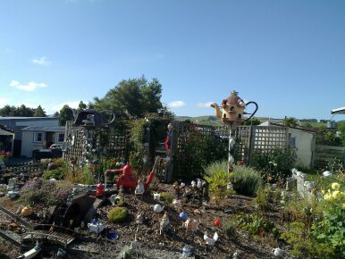 From Curio Bay Camping to Kaka Point Holiday Park, a distance of about 90kms and so about 56 miles. We set off rather late, partly because the campsite is relaxed about when you leave (it's difficult to police as it sprawls over the headland and the managers are delightfully laid back), partly because I argued to stay longer - rather nicely turned waves were comng in and my thoughts were turning to surf hire. Guy was keen to get on the move to places where he might solve his appalling back wheel - a reasonable desire I had to admit. But Curio Bay is the most pleasant place to be that we've yet found - exposed, wavy, remote, full of wildlife (sea lions on the beach each day, penguins and the occasional dolphin) and happily lacking in holiday home sprawl as yet. A Germansaid I was brave to cycle given the strong winds of recent days - I pointed out that today there is almost no wind. 'But this is a windy place!''Ah but half the time they are pushing you along!''But it is so slow!''Well you need some months - how long are you travelling for?''3 months''snap''Ah but we've got children with us''You'd have to do small days with lots of stops and fun things'He was evidently unconvinced and to be fair it would not be that easy to cover much ground on bikes with small children, though the Catlins would be very viable with small children - quieter roads and lots of beaches and campsites. Anyway we set off and headed through various tiny settlements on our way up the coast - a delicious route really, though for most of the day the weather was cool and cloudy. The road bobs up and down over modest hills, lots of views, curves, woods, and frequent views of the sea. Guy was being careful with his cracked back wheel - never going fast. This is essential though very frustrating on some of the downhills where you can speed down some nicely graded curves. Lunch was a toastie and dates at Papatowai (I was thinking of the Magic Flute duet - Papapapapapageno, papapapapapagena, etc). At the top of one modest climb was a commemorative plaque to do with the MacLelland region - years of dedicated service - but more curiously it was afixed to an old Clayton and Shuttleworth tractor wheel from yesteryear - a forge that existed until not all that long ago in Lincoln and which, bordering on the canal, I've often walked past. Then on to Okawa where we saw Teapotland (silly photo) and salad and red wine was obtained for the feast that then occurred another 17kms down the road at Kaka Point in the K Point Camp. Excellent. Some wonderful Pacific surf here - a fair number of good surfers offshore from the K Point Surf Club enjoying more than head high waves - 2m swell I reckon. From Curio Bay Camping to Kaka Point Holiday Park, a distance of about 90kms and so about 56 miles. We set off rather late, partly because the campsite is relaxed about when you leave (it's difficult to police as it sprawls over the headland and the managers are delightfully laid back), partly because I argued to stay longer - rather nicely turned waves were comng in and my thoughts were turning to surf hire. Guy was keen to get on the move to places where he might solve his appalling back wheel - a reasonable desire I had to admit. But Curio Bay is the most pleasant place to be that we've yet found - exposed, wavy, remote, full of wildlife (sea lions on the beach each day, penguins and the occasional dolphin) and happily lacking in holiday home sprawl as yet. A Germansaid I was brave to cycle given the strong winds of recent days - I pointed out that today there is almost no wind. 'But this is a windy place!''Ah but half the time they are pushing you along!''But it is so slow!''Well you need some months - how long are you travelling for?''3 months''snap''Ah but we've got children with us''You'd have to do small days with lots of stops and fun things'He was evidently unconvinced and to be fair it would not be that easy to cover much ground on bikes with small children, though the Catlins would be very viable with small children - quieter roads and lots of beaches and campsites. Anyway we set off and headed through various tiny settlements on our way up the coast - a delicious route really, though for most of the day the weather was cool and cloudy. The road bobs up and down over modest hills, lots of views, curves, woods, and frequent views of the sea. Guy was being careful with his cracked back wheel - never going fast. This is essential though very frustrating on some of the downhills where you can speed down some nicely graded curves. Lunch was a toastie and dates at Papatowai (I was thinking of the Magic Flute duet - Papapapapapageno, papapapapapagena, etc). At the top of one modest climb was a commemorative plaque to do with the MacLelland region - years of dedicated service - but more curiously it was afixed to an old Clayton and Shuttleworth tractor wheel from yesteryear - a forge that existed until not all that long ago in Lincoln and which, bordering on the canal, I've often walked past. Then on to Okawa where we saw Teapotland (silly photo) and salad and red wine was obtained for the feast that then occurred another 17kms down the road at Kaka Point in the K Point Camp. Excellent. Some wonderful Pacific surf here - a fair number of good surfers offshore from the K Point Surf Club enjoying more than head high waves - 2m swell I reckon.
|
|
25th Jan 2011 - Backwaters of New Zealand : Kaka Point to Lawrence
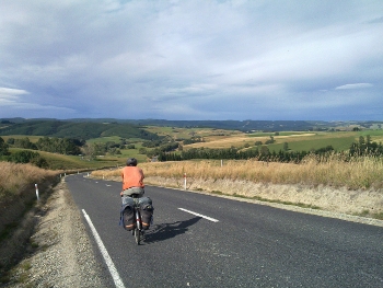 From Kaka Point to Lawrence, a small town formerly focussed on gold mining, about 85kms or 53 miles. This was a quiet days cycling. We headed out, noting by a quick paddle that Kaka Point sea was somewhat cold. My feet went numb just as they did in northern Scotland in Summer! So instead of a quick dip we tried to head off but in a moment of Laurel and Hardy silliness (ah we can laugh at it now!) Guy headed the wrong way (back towards Owaka by a geographical blunder) while Steve was staring out to sea assessing waves and a curious gannet like bird that was pottering about the beach (lovely white chest and a black head and back - quite curved in the neck). So Steve, when he turned around to find Guy gone, thought that Guy had disappeared (fed up of waiting) towards Balclutha and peddled quickly off to catch up. Guy ended up trying to catch up with Steve who was trying to catch up with Guy who was behind him... When that was sorted out (I got puzzled by Balclutha so started cycling back and so we met) we ate in a park at Balclutha (New World Supermarket so a nice variety) and eventually found the road to Lawrence. The rain arrived at Balclutha so we plodded damply on along the Clutha Valley admiring the impressive river which, we were surprised to discover on a noticeboard, is almost as big as the Nile (15% less). Clutha is gaelic for Clyde so it's a natural name for the early Scottish settlers to use. I think the Nile thing must be playing with the stats a bit but it is a pretty big, Thames like, river. We eventually headed away from the Clutha and followed a hilly road over to Lawrence. This was a very quiet road - perhaps a couple of cars per hour. Beautiful sunny (by now) countryside with a quiet road.Lawrence is very pretty really - old colonial style buildings and so quaint. It is in a picturesque location down in a valley. The campsite is big and quiet - we've just missed an arts festival so everyone was here earlier... From Kaka Point to Lawrence, a small town formerly focussed on gold mining, about 85kms or 53 miles. This was a quiet days cycling. We headed out, noting by a quick paddle that Kaka Point sea was somewhat cold. My feet went numb just as they did in northern Scotland in Summer! So instead of a quick dip we tried to head off but in a moment of Laurel and Hardy silliness (ah we can laugh at it now!) Guy headed the wrong way (back towards Owaka by a geographical blunder) while Steve was staring out to sea assessing waves and a curious gannet like bird that was pottering about the beach (lovely white chest and a black head and back - quite curved in the neck). So Steve, when he turned around to find Guy gone, thought that Guy had disappeared (fed up of waiting) towards Balclutha and peddled quickly off to catch up. Guy ended up trying to catch up with Steve who was trying to catch up with Guy who was behind him... When that was sorted out (I got puzzled by Balclutha so started cycling back and so we met) we ate in a park at Balclutha (New World Supermarket so a nice variety) and eventually found the road to Lawrence. The rain arrived at Balclutha so we plodded damply on along the Clutha Valley admiring the impressive river which, we were surprised to discover on a noticeboard, is almost as big as the Nile (15% less). Clutha is gaelic for Clyde so it's a natural name for the early Scottish settlers to use. I think the Nile thing must be playing with the stats a bit but it is a pretty big, Thames like, river. We eventually headed away from the Clutha and followed a hilly road over to Lawrence. This was a very quiet road - perhaps a couple of cars per hour. Beautiful sunny (by now) countryside with a quiet road.Lawrence is very pretty really - old colonial style buildings and so quaint. It is in a picturesque location down in a valley. The campsite is big and quiet - we've just missed an arts festival so everyone was here earlier...
|
|
26th Jan 2011 - Too Many Punctures
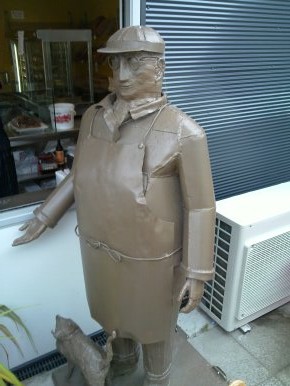 From Lawrence Motor Camp through to Alexandra Holiday Park, a distance of about 100 kms or about 63 miles. After leaving the campsite, we briefly explored Lawrence which is mainly notable for its gold mining past. In 1861 (yes, this year is the 150th anniversary) Gabriel Reade discovered gold in the little valley now called Gabriel's Gully. There was a short lived flurry of mining - 12000 rushed here at the peak. Agriculture is now the mainstay and the gold mining ceased a long time ago. Then we cycled along to the Clutha Valley (again) and on to Raes Junction. Then on over a mix of hilliness and flat valley roads to Roxburgh, the scenery being by then a delightful wide valley full of fruit trees. A visit to Jimmy's Pie Shop followed. Jimmy's Pies are a kiwi institution. Being mostly meat based they have not featured in our tour much. They do a fruit pie but that is rarely seen. We ate cakes and little savoury thingies. Not bad but why don't they indulge their visitors in a proper cafe - sitting outside in the rain was a bit wearing. The photo is the rather characterful metal statue of Jimmy - with cat. After Roxburgh the road got substantially hillier and then my back wheel kept puncturing - the tyre was falling a part at the seam and the inner tube was poking out. Very problematic. After a while I had swapped the front and back tyres so the front tyre was the failing one - and the front tyre can run at a lower pressure because I only have back panniers (the high pressure was what was forcing the inner tube out through the growing crack). I had to remove a brake at the front so the bulging tyre did not catch on it. I tightened the rear brakes and double checked them to compensate. This took ages so we limped, carefully, into Alexandra at about 8.30pm and found a campsite, ate a little and rapidly fell asleep. The landscape between Roxburgh and Alexandra is unusual - eroded rocks sit (tors - as on Dartmoor) on rolling rocky hills. Apparently they are eroded remnants of schizt - created when all this landscape was at the bottom of the sea. See the picture. Evidently tomorrow will have to be a mending things day - and a washing day because I ended today very dirty from changing wheels and mending punctures. Plus a late nose bleed added the finishing touch. Ah, the cyclist as traveller as tramp. From Lawrence Motor Camp through to Alexandra Holiday Park, a distance of about 100 kms or about 63 miles. After leaving the campsite, we briefly explored Lawrence which is mainly notable for its gold mining past. In 1861 (yes, this year is the 150th anniversary) Gabriel Reade discovered gold in the little valley now called Gabriel's Gully. There was a short lived flurry of mining - 12000 rushed here at the peak. Agriculture is now the mainstay and the gold mining ceased a long time ago. Then we cycled along to the Clutha Valley (again) and on to Raes Junction. Then on over a mix of hilliness and flat valley roads to Roxburgh, the scenery being by then a delightful wide valley full of fruit trees. A visit to Jimmy's Pie Shop followed. Jimmy's Pies are a kiwi institution. Being mostly meat based they have not featured in our tour much. They do a fruit pie but that is rarely seen. We ate cakes and little savoury thingies. Not bad but why don't they indulge their visitors in a proper cafe - sitting outside in the rain was a bit wearing. The photo is the rather characterful metal statue of Jimmy - with cat. After Roxburgh the road got substantially hillier and then my back wheel kept puncturing - the tyre was falling a part at the seam and the inner tube was poking out. Very problematic. After a while I had swapped the front and back tyres so the front tyre was the failing one - and the front tyre can run at a lower pressure because I only have back panniers (the high pressure was what was forcing the inner tube out through the growing crack). I had to remove a brake at the front so the bulging tyre did not catch on it. I tightened the rear brakes and double checked them to compensate. This took ages so we limped, carefully, into Alexandra at about 8.30pm and found a campsite, ate a little and rapidly fell asleep. The landscape between Roxburgh and Alexandra is unusual - eroded rocks sit (tors - as on Dartmoor) on rolling rocky hills. Apparently they are eroded remnants of schizt - created when all this landscape was at the bottom of the sea. See the picture. Evidently tomorrow will have to be a mending things day - and a washing day because I ended today very dirty from changing wheels and mending punctures. Plus a late nose bleed added the finishing touch. Ah, the cyclist as traveller as tramp.
|
|
27th Jan 2011 - Mending, Washing and Swimming in the River
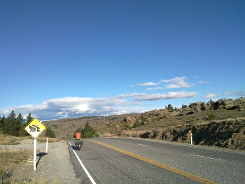 The photo is a typical bit of local landscape - rocky, dry and once a way below the sea (a few million years ago). Today was a mending day in which we tried to:Fix Guy's back wheel (splitting at the rim)Get both of us new tyres - especially since my back tyre is splitting and allowing inner tube to poke out. I also needed a new inner tube (the old spare got used after an impressively explosive puncture in the hills yesterday). Buy new bungees for me - kiwi bungees seem to have a short lifespan but I need them to bungee stuff onto the back of the bike now that I've no front bag (it failed ages ago). Buy new brake blocks. Wash all the dirty clothing. Most of this was achieved in the morning - tho' the bike wheel is on order to arrive for tomorrow morning. Then we visited the museum which explained the odd schizt landscape around here - tors of eroded rock and rising waves of hills. Then we headed back to swim in the river at the bottom of the campsite. The river is surprisingly warm and is very enjoyable to swim in since the current is gentle and you can walk or energetically swim up the river and then float downstream to where you started - this is the Manuherikia River not the much bigger Clutha which also flows through Alexandra. The photo is a typical bit of local landscape - rocky, dry and once a way below the sea (a few million years ago). Today was a mending day in which we tried to:Fix Guy's back wheel (splitting at the rim)Get both of us new tyres - especially since my back tyre is splitting and allowing inner tube to poke out. I also needed a new inner tube (the old spare got used after an impressively explosive puncture in the hills yesterday). Buy new bungees for me - kiwi bungees seem to have a short lifespan but I need them to bungee stuff onto the back of the bike now that I've no front bag (it failed ages ago). Buy new brake blocks. Wash all the dirty clothing. Most of this was achieved in the morning - tho' the bike wheel is on order to arrive for tomorrow morning. Then we visited the museum which explained the odd schizt landscape around here - tors of eroded rock and rising waves of hills. Then we headed back to swim in the river at the bottom of the campsite. The river is surprisingly warm and is very enjoyable to swim in since the current is gentle and you can walk or energetically swim up the river and then float downstream to where you started - this is the Manuherikia River not the much bigger Clutha which also flows through Alexandra.
|
|
28th Jan 2011 - a Wail Tail on the Rail Trail
From Alexandra to the Crow's Nest Backpackers and Camping, about 60-ish kms or 40 miles. The morning saw us rushing about to get Guy's bike back, with a new back wheel, from the Cycle and Mower Shop. Looks like a good wheel - tho' we are shockingly unclear as to whether it is double walled... - shopping for food and a camera (since Milford Sound my camera has ceased to have a working lcd screen - it takes pictured that you can see with a computer attached to it but the screen is useless). I got a cheapish Fujifilm AV110 to continue the photos of our journey with - prices in NZ seem very reasonable (on average a touch less than the UK high street). We were pretty much set to go so, of course, the day then turned rainy. But after a brief moment of hesitation we set off along the Otago Rail Trail that should, in a couple of days plus a restored little railway (Taieri Gorge Railway), take us to Dunedin (equals Edinburgh in scots gaelic). Guy is not a fan of rough tracks but the scenery - schizt outcrops and some gorges and tunnels - kept us both interested for the first 25 or so kms. But after a puncture and some pretty rough sections (as bad as a poor gravel road) Guy was getting desperate for tarmac and I was wearying of gravel. It is also so slow - we had a couple of campsites earmarked as possible but at the current rate it would be dark before we reached them. We met, on more offroad capable bikes than ours, Rene and Monique - two Germans who have been travelling in Australasia before coming here and bike touring. We had a great chat about bikes and roads and our journeys. They have a travel diary at http://www.2bikepackers.com. When Guy's tyre punctured (well, the old puncture repair fell apart from the constant banging of the tyre against stones) again we looked for the shortest route to tarmac and a campsite. The nearest accommodation was at Oturehua which we reached at about 8.15pm. Hooray for long summer evenings, otherwise it would have been tricky - the sun doesn't set until 9pm-ish and it remains light for a fair while after that. It isn't properly dark until around 10pm. We camped in the field at Crow's Nest Backpackers and had the used of the very homely kitchen and dining room along with some helpful meeows from the very elegant looking cat.The picture is of Guy mending his puncture (one of several) on the Rail Trail, while clouds build up over the hills around him. Looks like we're fated to get wet doesn't it? Well, it did rain later. Wonderful clouds though.
|
|
29th Jan 2011 - On and Off the Rail Trail
From Crow's Nest Backpackers (and camping), Oturehua, to Middlemarch Blind Billy's Campsite, about 90kms or 56 miles. A rather slow and quiet day. Slow because we involved ourselves on and off with the Central Otago Rail Trail, in spite of the punctures of yesterday; also slow because of the strong winds, side and headwinds, that buffeted us.
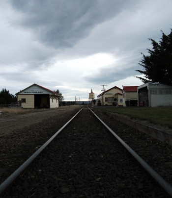 The day started cold with a hint of rain. We had breakfast (which Guy went to the old general grocers to buy - old style store with a long counter and heaps of goodies behind them) and set out. The first stretch took us along the highway 85 to Ranfurly. Ranfurly was cold and windy so we didn't do much other than huddle and eat lunch from the 4square supermarket. The sun then made a brief appearance so we chased after it along highway 85 and then turned off, into the wind, on highway 87. At Kokonga we turned off onto the Rail Trail and enjoyed the gorges and tunnel up until we reached Hyde. Here we met a seriously long distance cyclist from Ireland called Cillian. He had done a big bike ride in Europe and was now doing NZ and working at fruit picking in between times. He has a website (though he only updates it occasionally) at http://cillwalk.wordpress.com. He was doing the rail trail and sticking to it. So he headed off along the old trackbed while we opted for the paralleling road. The next 27kms to Middlemarch were slow because of a powerful headwind blowing slant on from the hills to the south of us. We rolled up at Middlemarch's Blind Jimmy's Holiday Park after all the food shops had shut (just icecreams were available at a craft store). We ate pasta in Avocado and Garlic dressing with mixed veg. Tasted OK. We ate in an old railway carriage that serves as the kitchen.And then fell rapidly asleep though evidently there is some sports event on the TV because a mass of blokes were drinking and shouting encouragement to some game in the TV room.The big photo at the top is of Guy, and with a bit of trickery he appears twice (yes, it's a panorama shot comprised of, I think, three shots sewn by the camera into one photo), enjoying a sunny moment on the rail trail. Worth treasuring because a lot of the time it wasn't sunny and Guy was mending his punctures.... The day started cold with a hint of rain. We had breakfast (which Guy went to the old general grocers to buy - old style store with a long counter and heaps of goodies behind them) and set out. The first stretch took us along the highway 85 to Ranfurly. Ranfurly was cold and windy so we didn't do much other than huddle and eat lunch from the 4square supermarket. The sun then made a brief appearance so we chased after it along highway 85 and then turned off, into the wind, on highway 87. At Kokonga we turned off onto the Rail Trail and enjoyed the gorges and tunnel up until we reached Hyde. Here we met a seriously long distance cyclist from Ireland called Cillian. He had done a big bike ride in Europe and was now doing NZ and working at fruit picking in between times. He has a website (though he only updates it occasionally) at http://cillwalk.wordpress.com. He was doing the rail trail and sticking to it. So he headed off along the old trackbed while we opted for the paralleling road. The next 27kms to Middlemarch were slow because of a powerful headwind blowing slant on from the hills to the south of us. We rolled up at Middlemarch's Blind Jimmy's Holiday Park after all the food shops had shut (just icecreams were available at a craft store). We ate pasta in Avocado and Garlic dressing with mixed veg. Tasted OK. We ate in an old railway carriage that serves as the kitchen.And then fell rapidly asleep though evidently there is some sports event on the TV because a mass of blokes were drinking and shouting encouragement to some game in the TV room.The big photo at the top is of Guy, and with a bit of trickery he appears twice (yes, it's a panorama shot comprised of, I think, three shots sewn by the camera into one photo), enjoying a sunny moment on the rail trail. Worth treasuring because a lot of the time it wasn't sunny and Guy was mending his punctures....
|
|
30th Jan 2011 - Taieri Gorge Railway
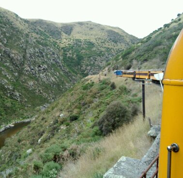 From Middlemarch (Blind Billy's Campsite) by the Taieri Gorge Railway through to Dunedin. And then a short bike ride to the Kiwi Holiday Park at St Kilda beach - so about 4kms on the bikes but lots of scenic railway kms.We paid our campsite fees ($11 each) and went to the railway station - discovered that there is no need to prebook the train and that you buy your tickets when the train comes in. So we had a look at the general store which was pretty much a typical very basic local store. Evidently all the serious shopping is done by a long drive to the big store 'in town' as in rural USA. Cillian was at the store and also a frenchman - we later chatted to him on the train.Then to the museum where Cillian joined us. There's a very impressive rusting submarine remnant outside - a failed attempt at gold panning using a submarine. Wacky and what a pity it didn't work though working conditions for gold miners were bad without involving cramped mini subs too!Cillian negotiated an organic cabbage with the local organic gardening lady and we pushed off to the station where the train was now in. We put bikes and panniers in the gards van - ah, reminiscent of the great British Rail days. Then we found our carriage and away the train went. The journey was excellent - tremendous views of gorges and bridges, more impressive scenery than the rail trail section. We wished we'd insisted upon Cillian coming with us on the train even by handing a ticket to him and we regret this omission - he was cycling to Dunedin instead. We hadn't realised how much the Taieri line is the culmination of the rail route from Alexandra to Dunedin.On arrival we headed for the Speights Brewery Tour - we don't generally rate Speights as much good but we were keen to see whether thery've got any decen beer hidden away and to see the beautiful coppers in which they brew.The tour was enjoyable - tho' the videos were marketing pap (the southern man thing looks more absurd the more you think about it)and a touch dumb. We got to see the coppers and indeed it is a beautiful brewery. They do brew a porter which is quite decent. We hadn't seen this anywhere so it was a positive thing. The rest of the range is ok but nothing stands out. Then a quick bowl of tasty but too expensive Thai food in the town before we hauled up at the Kiwi Camper at the back of a huge, but windy, cool and rough, beach - St. Kilda's. From Middlemarch (Blind Billy's Campsite) by the Taieri Gorge Railway through to Dunedin. And then a short bike ride to the Kiwi Holiday Park at St Kilda beach - so about 4kms on the bikes but lots of scenic railway kms.We paid our campsite fees ($11 each) and went to the railway station - discovered that there is no need to prebook the train and that you buy your tickets when the train comes in. So we had a look at the general store which was pretty much a typical very basic local store. Evidently all the serious shopping is done by a long drive to the big store 'in town' as in rural USA. Cillian was at the store and also a frenchman - we later chatted to him on the train.Then to the museum where Cillian joined us. There's a very impressive rusting submarine remnant outside - a failed attempt at gold panning using a submarine. Wacky and what a pity it didn't work though working conditions for gold miners were bad without involving cramped mini subs too!Cillian negotiated an organic cabbage with the local organic gardening lady and we pushed off to the station where the train was now in. We put bikes and panniers in the gards van - ah, reminiscent of the great British Rail days. Then we found our carriage and away the train went. The journey was excellent - tremendous views of gorges and bridges, more impressive scenery than the rail trail section. We wished we'd insisted upon Cillian coming with us on the train even by handing a ticket to him and we regret this omission - he was cycling to Dunedin instead. We hadn't realised how much the Taieri line is the culmination of the rail route from Alexandra to Dunedin.On arrival we headed for the Speights Brewery Tour - we don't generally rate Speights as much good but we were keen to see whether thery've got any decen beer hidden away and to see the beautiful coppers in which they brew.The tour was enjoyable - tho' the videos were marketing pap (the southern man thing looks more absurd the more you think about it)and a touch dumb. We got to see the coppers and indeed it is a beautiful brewery. They do brew a porter which is quite decent. We hadn't seen this anywhere so it was a positive thing. The rest of the range is ok but nothing stands out. Then a quick bowl of tasty but too expensive Thai food in the town before we hauled up at the Kiwi Camper at the back of a huge, but windy, cool and rough, beach - St. Kilda's.
|
|
31st Jan 2011 - Buzzing Around Dunedin...
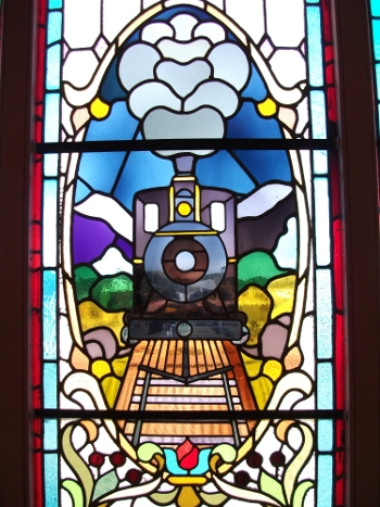 A day in Dunedin cycling around the city sights, so about 12kms or 8 miles of cycling. We decided to focus on the city centre and so we had a quick look at the art gallery and the anglican cathedral, and a longer time wandering around the botanic gardens. And we also called in briefly on the Railway Station - a lovely building with some impressive tiles and stained glass (as pictured to the left). The day was sunny but very windy, after a rainy and windy night (sleep interrupted when a huge gust arrived and threatened to topple the tent) and we spent the day trying not to think of whether the tent would still be standing when we returned.Dunedin Art Gallery is small but has some wonderful paintings - a nice stormy early Turner of little boats in a bay in big waves, a Monet of ice breaking up on a winter's day on the Seine (part of a series of studies of light, ice and landscape), a lovely modern picture by some NZ artist of a very modern woman smoking (Quaint Irene from Mapp and Lucia). Guy liked a picture of the young Walter Scott meeting the older Robbie Burns in Edinburgh. Pretty interesting - I assume there was a fair amount of mutual incomprehension in this (historical) meeting. There are a few abstracts but I didn't care for or understand them. They did a fair bit of curious juxtaposition - so the painting of a CEO of some megacorp was near to a picture of a tattooed and wise looking old Maori, who wasn't far from a picture of a shaggy haired artist drinking beer in the sun outside a bar.The cathedral was a little bit more complete than the one in Nelson but once again grand designs had met financial reality with curious consequences. The nave of the church was fine and included a lovely high vault. But the crossing and the chancel were not done and much later a concrete (faced with local stone) chancel was added. The styles don't mesh particularly well I reckon. I certainly miss stained glass and an east window.We also visited a couple of secondhand bookshops and various slim volumes nearly made it into the panniers. I resisted in the end because I bought a kindle ereader precisely to hold a huge heap of ebooks so I'm not short of things to read. At the moment it is Boswell's account of Samuel Johnson's Tour of the Hebrides. Very enjoyable - Johnson is a staffordshire hero, witty and wise! A day in Dunedin cycling around the city sights, so about 12kms or 8 miles of cycling. We decided to focus on the city centre and so we had a quick look at the art gallery and the anglican cathedral, and a longer time wandering around the botanic gardens. And we also called in briefly on the Railway Station - a lovely building with some impressive tiles and stained glass (as pictured to the left). The day was sunny but very windy, after a rainy and windy night (sleep interrupted when a huge gust arrived and threatened to topple the tent) and we spent the day trying not to think of whether the tent would still be standing when we returned.Dunedin Art Gallery is small but has some wonderful paintings - a nice stormy early Turner of little boats in a bay in big waves, a Monet of ice breaking up on a winter's day on the Seine (part of a series of studies of light, ice and landscape), a lovely modern picture by some NZ artist of a very modern woman smoking (Quaint Irene from Mapp and Lucia). Guy liked a picture of the young Walter Scott meeting the older Robbie Burns in Edinburgh. Pretty interesting - I assume there was a fair amount of mutual incomprehension in this (historical) meeting. There are a few abstracts but I didn't care for or understand them. They did a fair bit of curious juxtaposition - so the painting of a CEO of some megacorp was near to a picture of a tattooed and wise looking old Maori, who wasn't far from a picture of a shaggy haired artist drinking beer in the sun outside a bar.The cathedral was a little bit more complete than the one in Nelson but once again grand designs had met financial reality with curious consequences. The nave of the church was fine and included a lovely high vault. But the crossing and the chancel were not done and much later a concrete (faced with local stone) chancel was added. The styles don't mesh particularly well I reckon. I certainly miss stained glass and an east window.We also visited a couple of secondhand bookshops and various slim volumes nearly made it into the panniers. I resisted in the end because I bought a kindle ereader precisely to hold a huge heap of ebooks so I'm not short of things to read. At the moment it is Boswell's account of Samuel Johnson's Tour of the Hebrides. Very enjoyable - Johnson is a staffordshire hero, witty and wise!
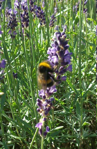 The Botanical Garden has a decent Rose Garden (and some David Austin roses - so I recognised some). It also has some wonderful old trees (and giant Redwoods), a South African garden, and lots of NZ plants. Plus some impressive herbaceous borders. The teahouse (called The Crocodile) has very good value tea in a proper tea pot with a pot of water. This is a relatively unusual level of tea understanding for NZ. We ended our botanicals with a laze around in the herb garden where drifts of french lavender surrounded plantings of hibiscus, sage, etc. The photo is of a bee visiting the lavender.Finally back, via the supermarket, to the Kiwi Camper Park. It's a bit 'police state' is our campground - surveillance cameras even in the kitchen, most facilities are locked up at 10pm (so no hot chocomilk to take back to the tent to help you fall asleep). And the 10am check out time is emphasized over heavily.The wind was calming down, and after a quick visit to the cool and exposed beach (St Kilda's) we ate (drinking Moa Brewery's Belgian Tripel - very good indeed), drank tea and fell asleep. The Botanical Garden has a decent Rose Garden (and some David Austin roses - so I recognised some). It also has some wonderful old trees (and giant Redwoods), a South African garden, and lots of NZ plants. Plus some impressive herbaceous borders. The teahouse (called The Crocodile) has very good value tea in a proper tea pot with a pot of water. This is a relatively unusual level of tea understanding for NZ. We ended our botanicals with a laze around in the herb garden where drifts of french lavender surrounded plantings of hibiscus, sage, etc. The photo is of a bee visiting the lavender.Finally back, via the supermarket, to the Kiwi Camper Park. It's a bit 'police state' is our campground - surveillance cameras even in the kitchen, most facilities are locked up at 10pm (so no hot chocomilk to take back to the tent to help you fall asleep). And the 10am check out time is emphasized over heavily.The wind was calming down, and after a quick visit to the cool and exposed beach (St Kilda's) we ate (drinking Moa Brewery's Belgian Tripel - very good indeed), drank tea and fell asleep.
|
|